
📷 Greek Peak
North America
Greek Peak
Pre-season — not open yet
Projected to open November 29, 2026
Conditions data updated Sat, Jul 4, 04:03 PM UTC · informational only
Scroll for happiness
Closed for Season
Weather data is still collected for informational purposes.
Last Snowfall
--
Past 24 Hours
0cm
Past 48 Hours
0cm
Past 10 Days
0cm
14-Day Forecast
0cm
Snow Depth
--
Overview
Greek Peak is a ski resort in North America, United States, currently closed for the season (Projected to open November 29, 2026). Today's SnowSure™ Score is 10/100 (Limited). Conditions last updated 2026-07-04 16:03 UTC.
Resort Guide
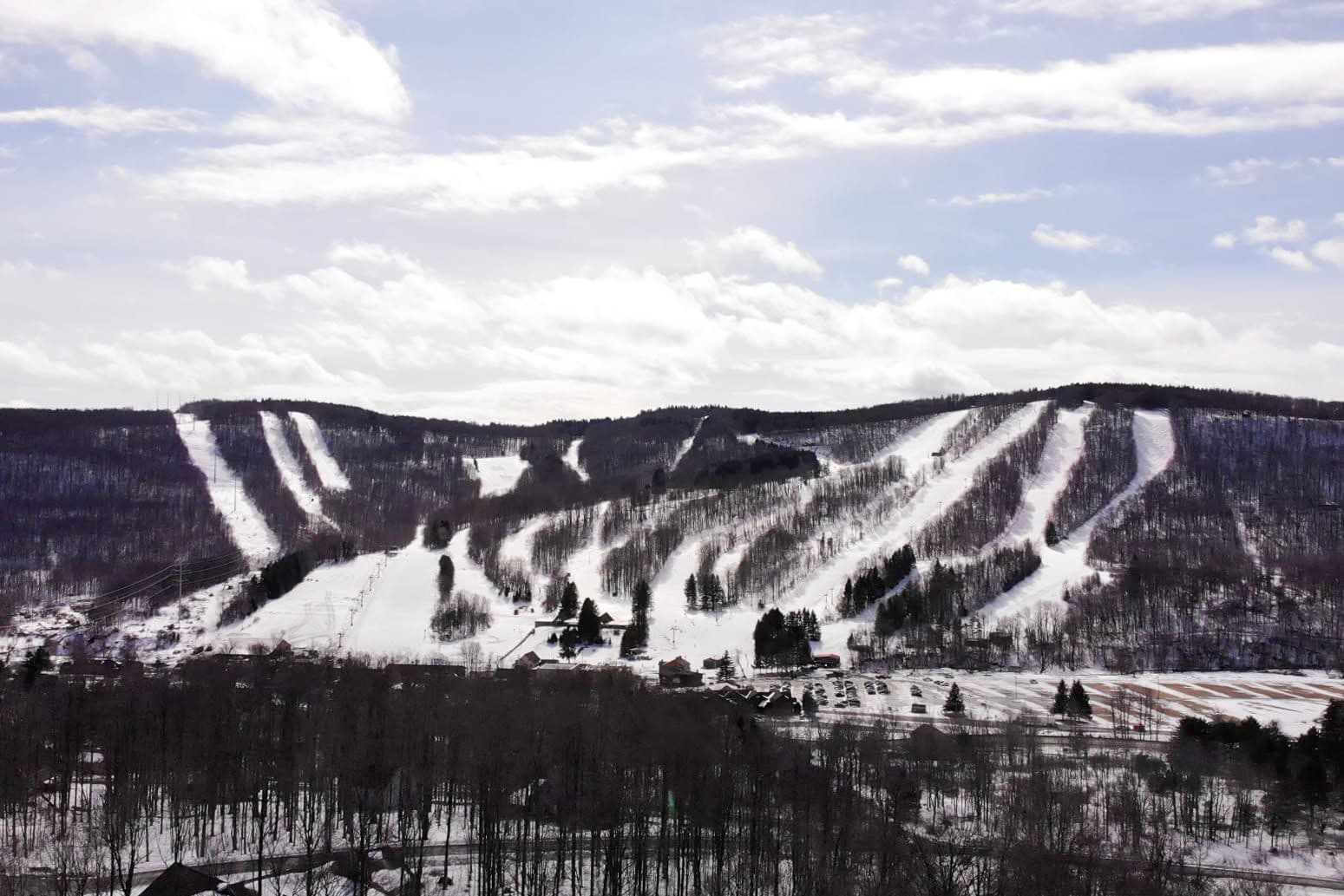
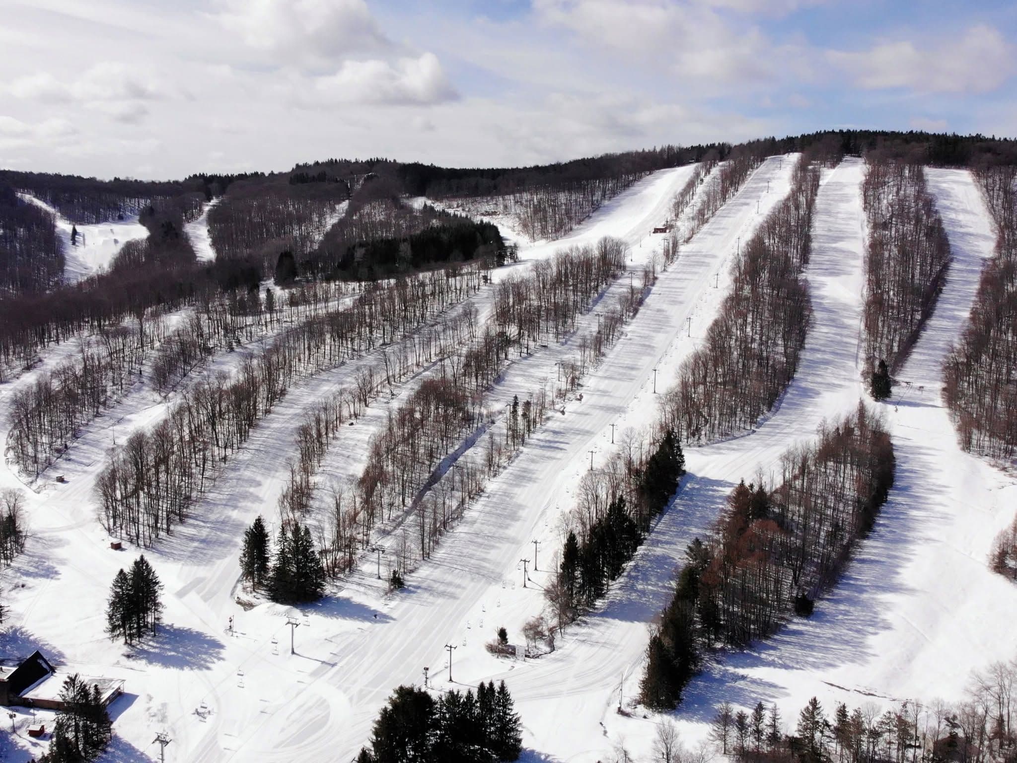
Greek Peak is located in the Finger Lakes region of New York and features 55 trails across varied terrain suitable for all skill levels. The resort offers a family-friendly atmosphere with amenities including a full-service spa, indoor waterpark, and ski-in/ski-out accommodations. Signature experiences include night skiing, a mountain coaster, and adaptive snowsports programs, making it a versatile destination for both recreation and relaxation.
Gallery
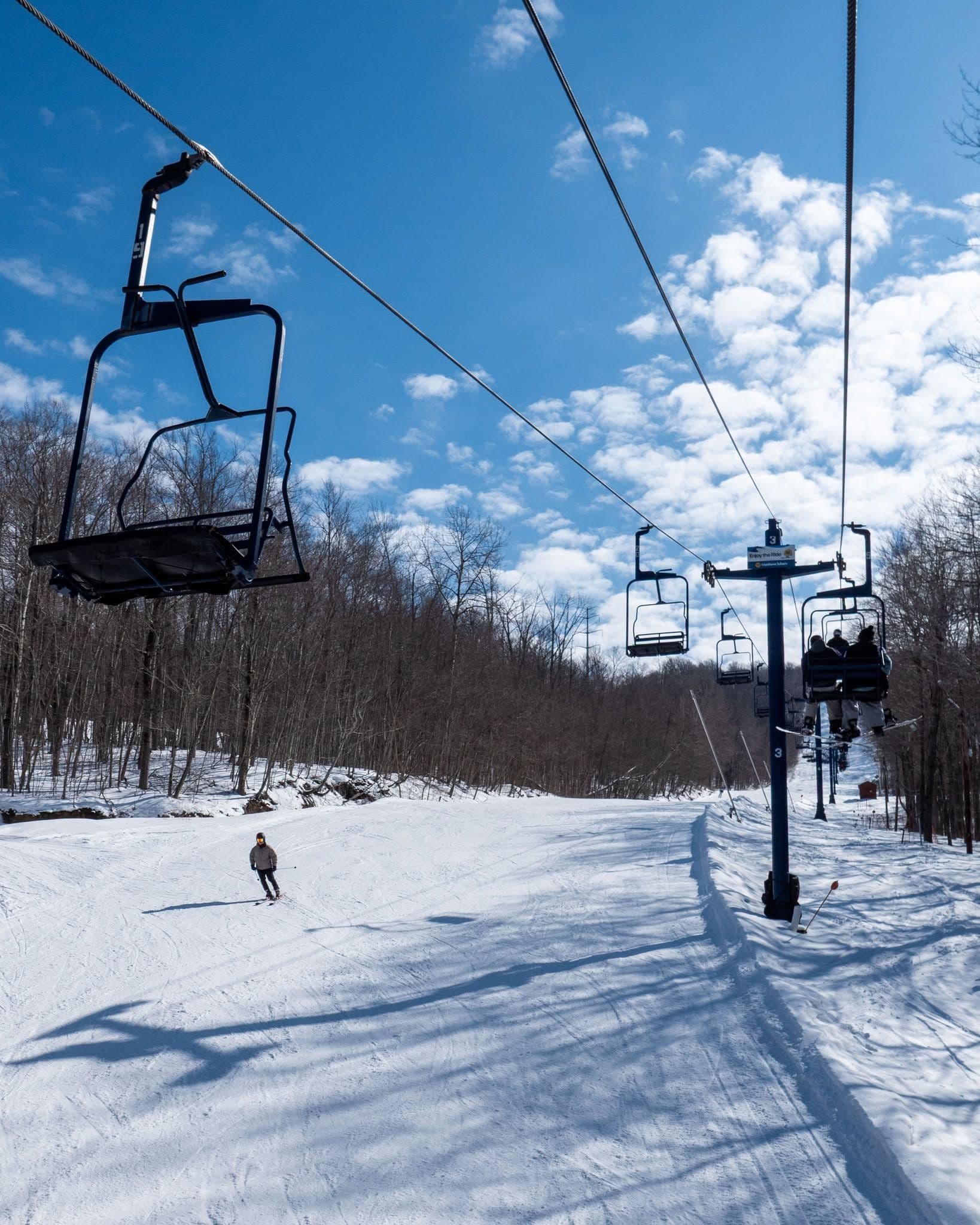
Click to expand • 4 total photos
Terrain & lifts
Resort-reported stats for Greek Peak
Lifts
9
Skiable area
543.6 ac
Longest run
2.4 km / 1.5 mi
Runs by difficulty(56 total)
Beginner
23
41% of terrain
Intermediate
18
33% of terrain
Advanced
15
26% of terrain
Run counts estimated from resort-reported totals and terrain mix.
Lift fleet
- High-speed quad1
- Triple chair2
- Double chair3
- Surface lift2
Snowmaking covers about 83% of terrain.
Resort Info
Season dates
Future dates are operator estimates and may change.
Ski passes
Indy Pass
Access tiers change by season — confirm benefits on the pass operator's site.
Top Après Ski
Trax Pub & Grill – Located at the base of Greek Peak, Trax is renowned for its spacious deck, live music events, and vibrant après-ski scene, making it the go-to spot for skiers and snowboarders to unwind with craft beers and hearty fare after a day on the slopes.
Not operating — not open yet
Projected to open November 29, 2026
SnowSure scores and forecasts below are for planning and reference only while the resort is closed.
Depth
Snowpack still building before opening — no base depth yet.
Recent
There has been no new snowfall in the past week.
Forecast
The 14-day snow outlook indicates minimal precipitation, so planning for early season conditions is advisable.
Historic
Currently, the season-to-date snowfall is not meaningful yet as it is too early to judge the season compared to the 5-year average to-date of 125cm.
Closed for the season · Data updated Sat, Jul 4, 04:03 PM UTC · informational only
Snow Summary
Updated Jul 4, 2026 at 4:03 PM
Historical data from Open-Meteo archive • Forecast from ECMWF IFS model
Snowfall Forecast Maps
Mid-Atlantic & Appalachians region
Current Conditions
Reported Sat, Jul 4, 04:03 PM UTC
Base
350m
Temp
24°C
Wind
16.6km/h
Snow Depth
--
14-Day Forecast
0cm
Mid-Mountain
495m
Temp
--°C
Wind
18km/h
Snow Depth
--
14-Day Forecast
0cm
Summit
640m
Temp
22.1°C
Wind
16.6km/h
Snow Depth
--
14-Day Forecast
0cm
Local Reports
0 reportsDaily Snowfall Forecast by Model
Black line = verified SnowSure™ blend (not a simple average). Weights update weekly from measured snowfall at SNOTEL stations and resort reports.
SnowSure™ blend — verified model weighting
The black line is not a simple average. For Greek Peak (rockies), we combine seven global weather models using weights learned from daily forecast verification — comparing each model's prediction to measured snowfall (SNOTEL, resort reports, ERA5).
- 1.Horizon buckets: days 1–3, 4–7, and 8–14 each get separate weights — short-range skill differs from long-range.
- 2.Regional calibration: weights come from verified error in this geography (Rockies, Alps, Japan, etc.), recalculated weekly.
- 3.Ground truth only: we never grade a forecast against another model — only against measured snow.
Building verification history for this resort.
How we verify forecasts →Hourly Forecast Detail
AM / PM / Night breakdown with wind and freezing level
NWP models refresh up to 4× daily · Last synced Jul 4, 4:03 PM
Today 24 / 1816.5mm | Sun, Jul 5 22 / 179.6mm | Mon, Jul 6 21 / 1615.9mm | Tue, Jul 7 21 / 140.9mm | Wed, Jul 8 24 / 15 | Thu, Jul 9 24 / 179.3mm | |||||||||||||
|---|---|---|---|---|---|---|---|---|---|---|---|---|---|---|---|---|---|---|
| Period | AM | PM | Night | AM | PM | Night | AM | PM | Night | AM | PM | Night | AM | PM | Night | AM | PM | Night |
| Snow (cm) | 0 | 0 | 0 | 0 | 0 | 0 | 0 | 0 | 0 | 0 | 0 | 0 | 0 | 0 | 0 | 0 | 0 | 0 |
| Precip (mm) | 2.4 | 2.7 | 11.4 | 0.9 | 4.8 | 3.9 | 7.8 | 0.6 | 7.5 | 0 | 0 | 0.9 | 0 | 0 | 0 | 0 | 6.9 | 2.4 |
| Temp (°C) | 20 | 23 | 19 | 20 | 21 | 18 | 18 | 21 | 18 | 17 | 20 | 17 | 18 | 23 | 18 | 19 | 23 | 19 |
| Wind (km/h) | 13 | 18 | 6 | 2 | 9 | 5 | 14 | 16 | 12 | 11 | 12 | 10 | 8 | 10 | 8 | 14 | 15 | 14 |
| Gusts (km/h) | 29 | 39 | 23 | 11 | 20 | 11 | 27 | 33 | 22 | 24 | 26 | 20 | 17 | 18 | 20 | 17 | 22 | 17 |
14-Day Snow Forecast by Model
Summit elevation (640m)
10-Day Forecast
Today
4
🌦️
24°
18.2°
19 km/h
Sun
5
🌧️
21.7°
17.4°
13 km/h
Mon
6
🌧️
21.2°
16.3°
16 km/h
Tue
7
🌧️
21.4°
14.4°
13 km/h
Wed
8
☁️
23.7°
14.5°
12 km/h
Thu
9
🌦️
24.2°
17°
16 km/h
Fri
10
🌧️
23.8°
18.8°
14 km/h
Sat
11
🌧️
22.6°
17.6°
10 km/h
Sun
12
☀️
24.8°
16.3°
10 km/h
Mon
13
🌧️
20.7°
17.4°
11 km/h
Summit elevation (640m) • ECMWF model
Season vs Historic
Updated Sat, Jul 4, 04:03 PM UTC
0cm
Season Total
This Season to Date
—
vs 5-Year Avg
Off-season · 125cm full-season avg
—
vs 30-Year Avg
Off-season · 125cm full-season avg
125cm
5-Yr Avg by Now
Over the past five years, average seasonal snowfall has slightly decreased compared to the 30-year average, with the 5-year mean at 143.6 cm versus the long-term average of 149.3 cm. The most recent season's snowfall matches the 5-year average but remains 4% below the 30-year norm. Notable variability is evident, with a significant low in 2023 (110.7 cm) followed by a rebound in 2024 (134.7 cm), though neither reached the higher totals observed in 2021 and 2022. This pattern suggests a modest downward trend with increased year-to-year fluctuations.
Greek Peak Snow History
Average annual snowfall is 149cm with an average of 87 snowfall days per season. The table below shows monthly averages across 30 seasons of archive data (modeled snowpack at mid-elevation).
| Month | Avg Snowfall | Snowfall Days | Avg Base Depth | Max Base Depth | Biggest Snowfall |
|---|---|---|---|---|---|
| November | 12.9cm | 9 days | 2cm | 7cm | 4.3cm |
| December | 32.2cm | 18 days | 10cm | 21cm | 9.1cm |
| January | 33.5cm | 21 days | 18cm | 32cm | 8.1cm |
| February | 31.2cm | 17 days | 23cm | 36cm | 9.5cm |
| March | 26.9cm | 13 days | 15cm | 31cm | 9cm |
| April | 10.4cm | 6 days | 2cm | 11cm | 5.2cm |
| May | 0.7cm | 1 days | 0cm | 3cm | 2cm |
Source: SnowSure archive · Open-Meteo ERA5 reanalysis at mid-elevation. Depth is modeled, not resort-reported.
Season at a Glance
Next season(2026-27)
Opens Nov 29, 2026
Multi-season averages will appear once SnowSure has tracked more than one full season.
Best Months to Visit
February
Peak Season
January
Peak Season
March
Good
December
Good
Note: Based on typical ski season patterns for this region.


