
📷 Palandöken
Asia
Palandöken
Pre-season — not open yet
Projected to open November 29, 2026
Conditions data updated Sat, Jul 4, 04:04 PM UTC · informational only
Scroll for happiness
Closed for Season
Weather data is still collected for informational purposes.
Last Snowfall
Jun 2
Past 24 Hours
0cm
Past 48 Hours
0cm
Past 10 Days
0cm
14-Day Forecast
0cm
Snow Depth
--
Overview
Palandöken is a ski resort in Asia, Turkey, currently closed for the season (Projected to open November 29, 2026). Today's SnowSure™ Score is 10/100 (Limited). Conditions last updated 2026-07-04 16:04 UTC.
Resort Guide
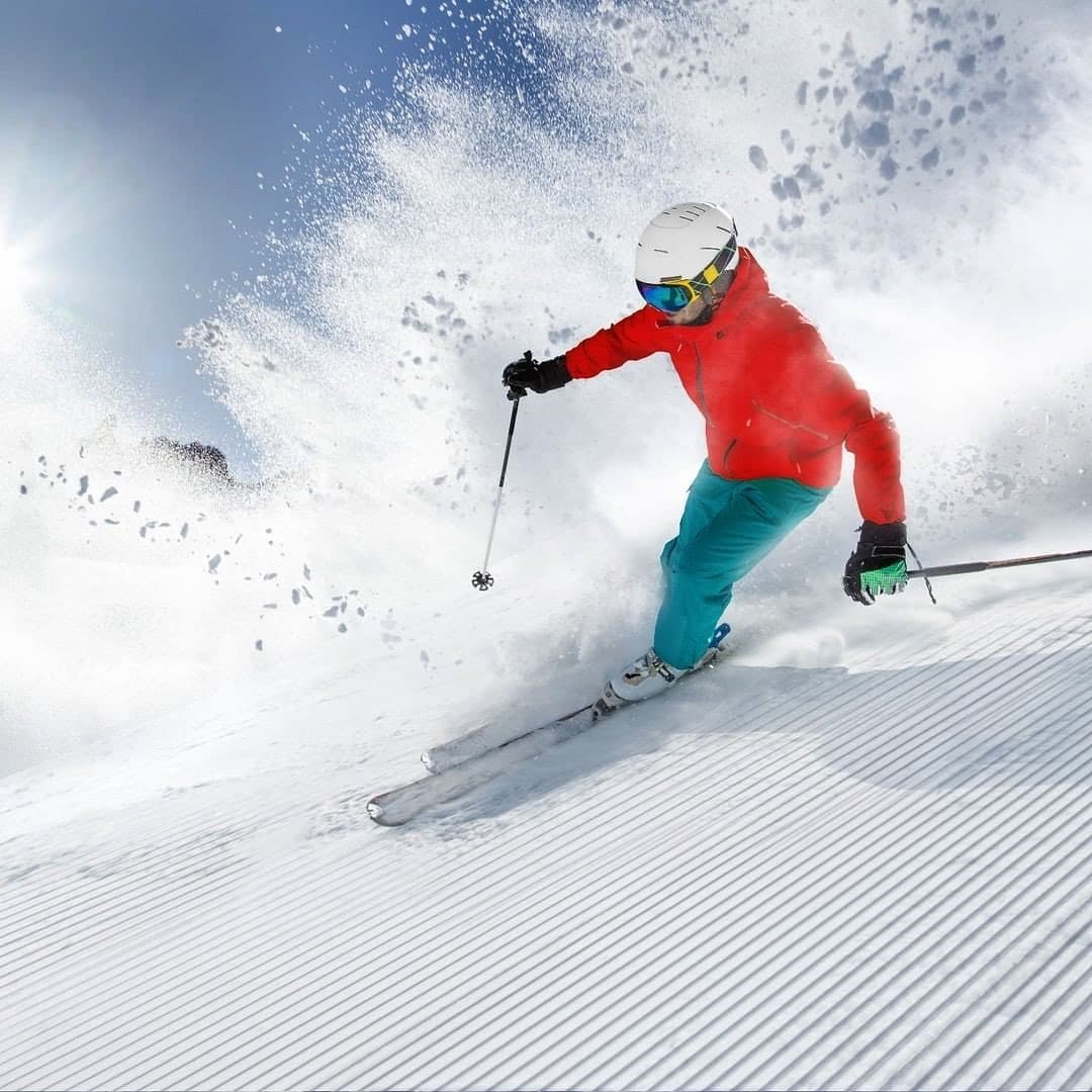
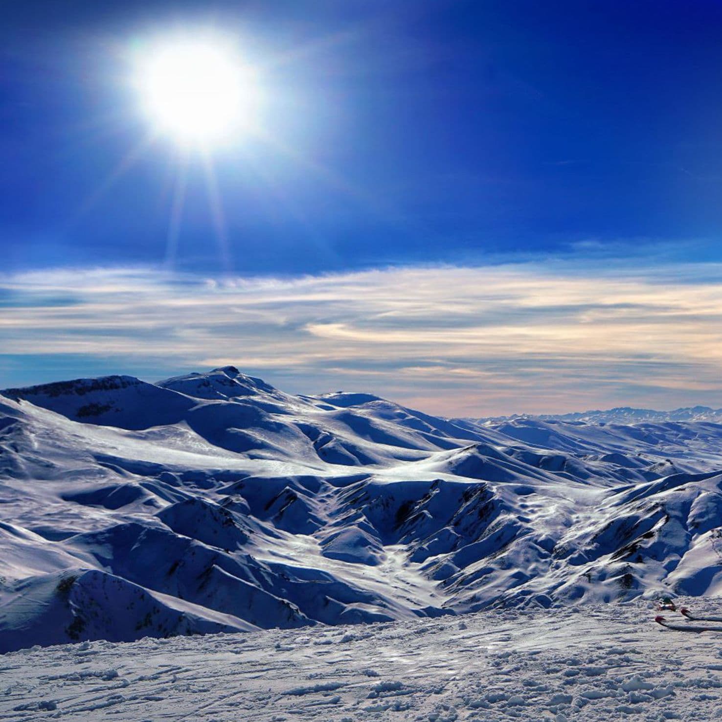
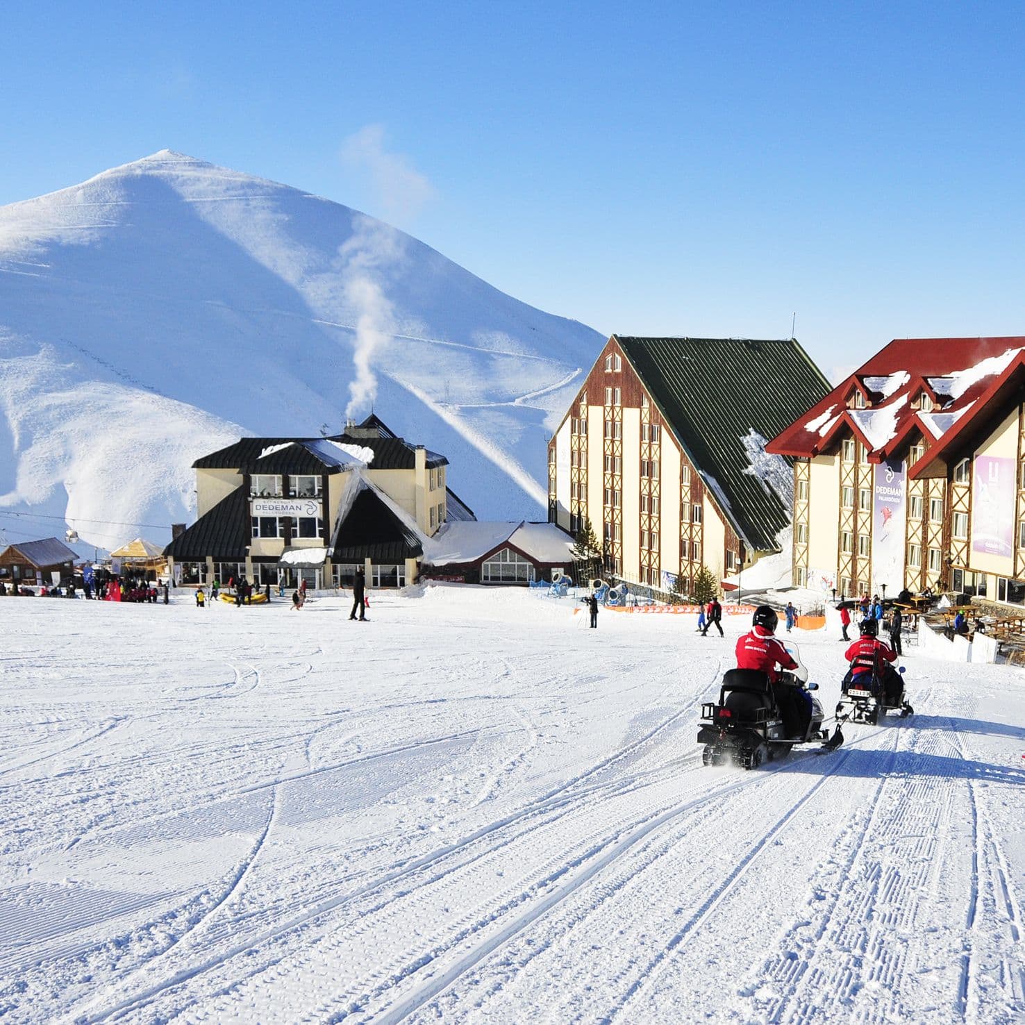
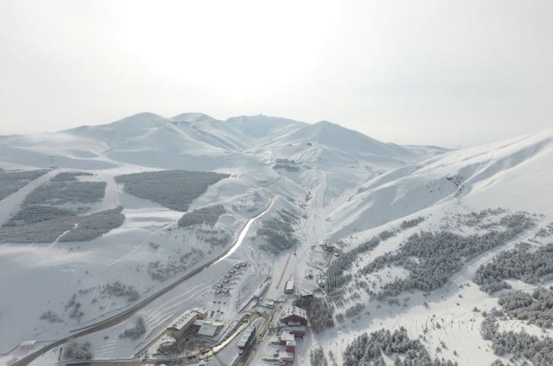
Palandöken Ski Resort is located in Erzurum, Turkey, and is renowned for its long ski season, high-altitude slopes, and modern lift infrastructure. The resort features a variety of runs suitable for all levels, including some of the longest and steepest pistes in Turkey, and offers night skiing, snowboarding, and snow parks. Visitors benefit from direct access to the slopes from nearby hotels, a family-friendly atmosphere, and panoramic views of the surrounding mountains. Palandöken stands out for its reliable snow conditions and proximity to Erzurum city, making it easily accessible for both local and international guests.
Gallery
Click to expand • 5 total photos
Terrain & lifts
Resort-reported stats for Palandöken
Lifts
16
Skiable area
262.7 ac
Longest run
15 km / 9.3 mi
Runs by difficulty(55 total)
Beginner
24
44% of terrain
Intermediate
14
26% of terrain
Advanced
17
30% of terrain
Run counts estimated from resort-reported totals and terrain mix.
Lift fleet
- Gondola2
- High-speed quad3
- Quad chair3
- Triple chair1
- Double chair3
- Surface lift1
Resort Info
Season dates
Future dates are operator estimates and may change.
Ski passes
Indy Pass
Access tiers change by season — confirm benefits on the pass operator's site.
Top Après Ski
Dedeman Ski Lodge Bar – Renowned for its cozy atmosphere and panoramic mountain views, this bar at the Dedeman Palandöken Hotel is a favorite après-ski spot where guests enjoy warm drinks, live music, and a welcoming ambiance after a day on the slopes.
Not operating — not open yet
Projected to open November 29, 2026
SnowSure scores and forecasts below are for planning and reference only while the resort is closed.
Depth
Snowpack still building before opening — no base depth yet.
Recent
There has been no new snowfall in the past week.
Forecast
The 14-day snow outlook is currently unavailable, but colder temperatures are anticipated.
Historic
It is too early to judge the season as current conditions are in line with early season trends compared to the 5-year average to-date of 245cm.
Closed for the season · Data updated Sat, Jul 4, 04:04 PM UTC · informational only
Snow Summary
Updated Jul 4, 2026 at 4:04 PM
Historical data from Open-Meteo archive • Forecast from ECMWF IFS model
Snowfall Forecast Maps
Caucasus & Eastern Turkey region
Current Conditions
Reported Sat, Jul 4, 04:04 PM UTC
Depth by source
every reading we have- GHCNBase 1cm
The headline depth uses the most trusted available source. We show every reading so you can judge for yourself.
Base
2200m
Temp
16.5°C
Wind
11.2km/h
Snow Depth
--
14-Day Forecast
0cm
Mid-Mountain
2688m
Temp
13.3°C
Wind
12km/h
Snow Depth
--
14-Day Forecast
0cm
Summit
3176m
Temp
10.1°C
Wind
11.2km/h
Snow Depth
--
14-Day Forecast
0cm
Local Reports
0 reportsDaily Snowfall Forecast by Model
Black line = verified SnowSure™ blend (not a simple average). Weights update weekly from measured snowfall at SNOTEL stations and resort reports.
SnowSure™ blend — verified model weighting
The black line is not a simple average. For Palandöken (alps), we combine seven global weather models using weights learned from daily forecast verification — comparing each model's prediction to measured snowfall (SNOTEL, resort reports, ERA5).
- 1.Horizon buckets: days 1–3, 4–7, and 8–14 each get separate weights — short-range skill differs from long-range.
- 2.Regional calibration: weights come from verified error in this geography (Rockies, Alps, Japan, etc.), recalculated weekly.
- 3.Ground truth only: we never grade a forecast against another model — only against measured snow.
Building verification history for this resort.
How we verify forecasts →Hourly Forecast Detail
AM / PM / Night breakdown with wind and freezing level
NWP models refresh up to 4× daily · Last synced Jul 4, 4:04 PM
Today 14 / 52.7mm | Sun, Jul 5 13 / 44.5mm | Mon, Jul 6 13 / 510.2mm | Tue, Jul 7 13 / 39.3mm | Wed, Jul 8 12 / 43mm | Thu, Jul 9 14 / 60.6mm | |||||||||||||
|---|---|---|---|---|---|---|---|---|---|---|---|---|---|---|---|---|---|---|
| Period | AM | PM | Night | AM | PM | Night | AM | PM | Night | AM | PM | Night | AM | PM | Night | AM | PM | Night |
| Snow (cm) | 0 | 0 | 0 | 0 | 0 | 0 | 0 | 0 | 0 | 0 | 0 | 0 | 0 | 0 | 0 | 0 | 0 | 0 |
| Precip (mm) | 0.4 | 0.9 | 1.4 | 0.6 | 1.9 | 2 | 0.4 | 8.8 | 1 | 0.6 | 6.8 | 1.9 | 0.2 | 2.1 | 0.7 | 0.2 | 0.4 | 0 |
| Temp (°C) | 10 | 13 | 7 | 7 | 12 | 6 | 9 | 11 | 6 | 9 | 10 | 5 | 8 | 11 | 5 | 10 | 14 | 8 |
| Wind (km/h) | 3 | 14 | 6 | 5 | 6 | 4 | 6 | 7 | 4 | 4 | 6 | 4 | 5 | 8 | 4 | 7 | 15 | 3 |
| Gusts (km/h) | 15 | 37 | 16 | 17 | 21 | 12 | 20 | 27 | 13 | 18 | 27 | 16 | 16 | 25 | 19 | 21 | 36 | 25 |
14-Day Snow Forecast by Model
Summit elevation (3176m)
10-Day Forecast
Today
4
🌧️
13.8°
5.2°
16 km/h
Sun
5
🌧️
12.8°
3.7°
10 km/h
Mon
6
🌧️
12.7°
4.7°
8 km/h
Tue
7
🌧️
13.3°
3.3°
7 km/h
Wed
8
🌧️
11.9°
3.7°
11 km/h
Thu
9
🌧️
13.9°
5.5°
17 km/h
Fri
10
🌤️
15.1°
5.2°
17 km/h
Sat
11
⛅
16.2°
3.6°
5 km/h
Sun
12
☁️
17.8°
8°
7 km/h
Mon
13
🌤️
16.9°
8.1°
14 km/h
Summit elevation (3176m) • ECMWF model
Season vs Historic
Updated Sat, Jul 4, 04:04 PM UTC
0cm
Season Total
This Season to Date
—
vs 5-Year Avg
Off-season · 245cm full-season avg
—
vs 30-Year Avg
Off-season · 245cm full-season avg
245cm
5-Yr Avg by Now
Over the past five years, average seasonal snowfall has increased to 285.3 cm, notably higher than the 30-year average of 237.6 cm, indicating a recent upward trend. The current season's snowfall is 1% above the recent 5-year average and 22% above the long-term average, reinforcing this positive shift. However, significant year-to-year variability is evident, with snowfall ranging from a low of 220.8 cm in 2020 to a high of 345.7 cm in 2021. This variability suggests that while the overall trend is upward, individual seasons can still deviate substantially from the average.
Palandöken Snow History
Average annual snowfall is 266cm with an average of 101 snowfall days per season. The table below shows monthly averages across 30 seasons of archive data (modeled snowpack at mid-elevation).
| Month | Avg Snowfall | Snowfall Days | Avg Base Depth | Max Base Depth | Biggest Snowfall |
|---|---|---|---|---|---|
| November | 25.1cm | 10 days | 6cm | 16cm | 8.9cm |
| December | 35.9cm | 14 days | 22cm | 36cm | 9.4cm |
| January | 37.4cm | 15 days | 42cm | 58cm | 8.9cm |
| February | 40.4cm | 15 days | 60cm | 76cm | 10.3cm |
| March | 57.7cm | 18 days | 68cm | 86cm | 11.4cm |
| April | 40.4cm | 15 days | 49cm | 75cm | 9.2cm |
| May | 16.6cm | 8 days | 8cm | 31cm | 6cm |
Source: SnowSure archive · Open-Meteo ERA5 reanalysis at mid-elevation. Depth is modeled, not resort-reported.
Season at a Glance
Next season(2026-27)
Opens Nov 29, 2026
Multi-season averages will appear once SnowSure has tracked more than one full season.
Best Months to Visit
February
Peak Season
January
Peak Season
March
Good
December
Good
Note: Based on typical ski season patterns for this region.


