
📷 Swain
North America
Swain
Pre-season — not open yet
Projected to open December 19, 2026
Conditions data updated Sat, Jul 4, 04:05 PM UTC · informational only
Scroll for happiness
Closed for Season
Weather data is still collected for informational purposes.
Last Snowfall
--
Past 24 Hours
0cm
Past 48 Hours
0cm
Past 10 Days
0cm
14-Day Forecast
0cm
Snow Depth
--
Overview
Swain is a ski resort in North America, United States, currently closed for the season (Projected to open December 19, 2026). Today's SnowSure™ Score is 10/100 (Limited). Conditions last updated 2026-07-04 16:05 UTC.
Resort Guide
Swain Resort is located in Western New York and features 35 trails across 120 skiable acres, catering to a range of abilities from beginner to advanced. The resort offers a relaxed, family-friendly atmosphere with amenities including a terrain park, ski and snowboard lessons, equipment rentals, and on-site dining. Swain is known for its approachable slopes, night skiing, and a welcoming environment ideal for families and groups.
Gallery
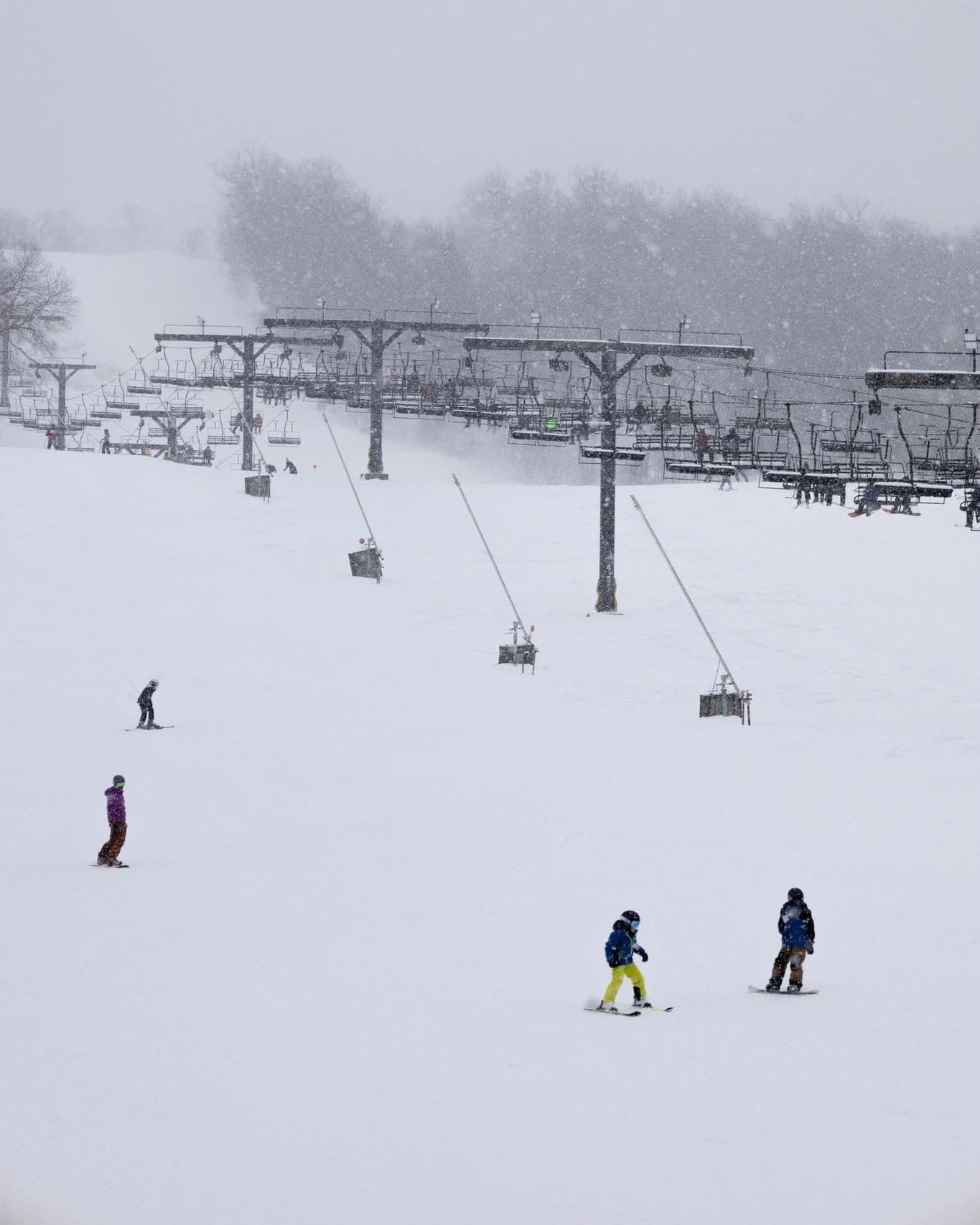
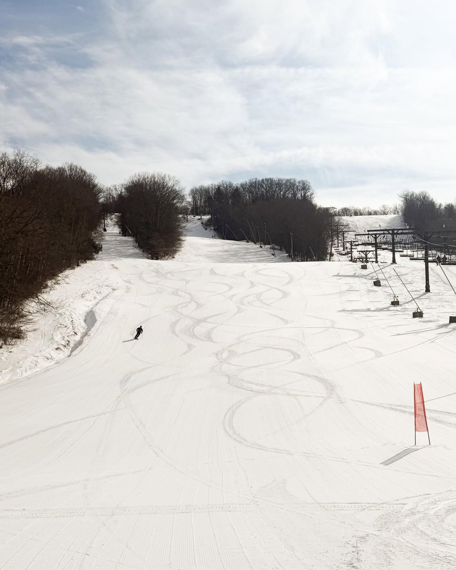
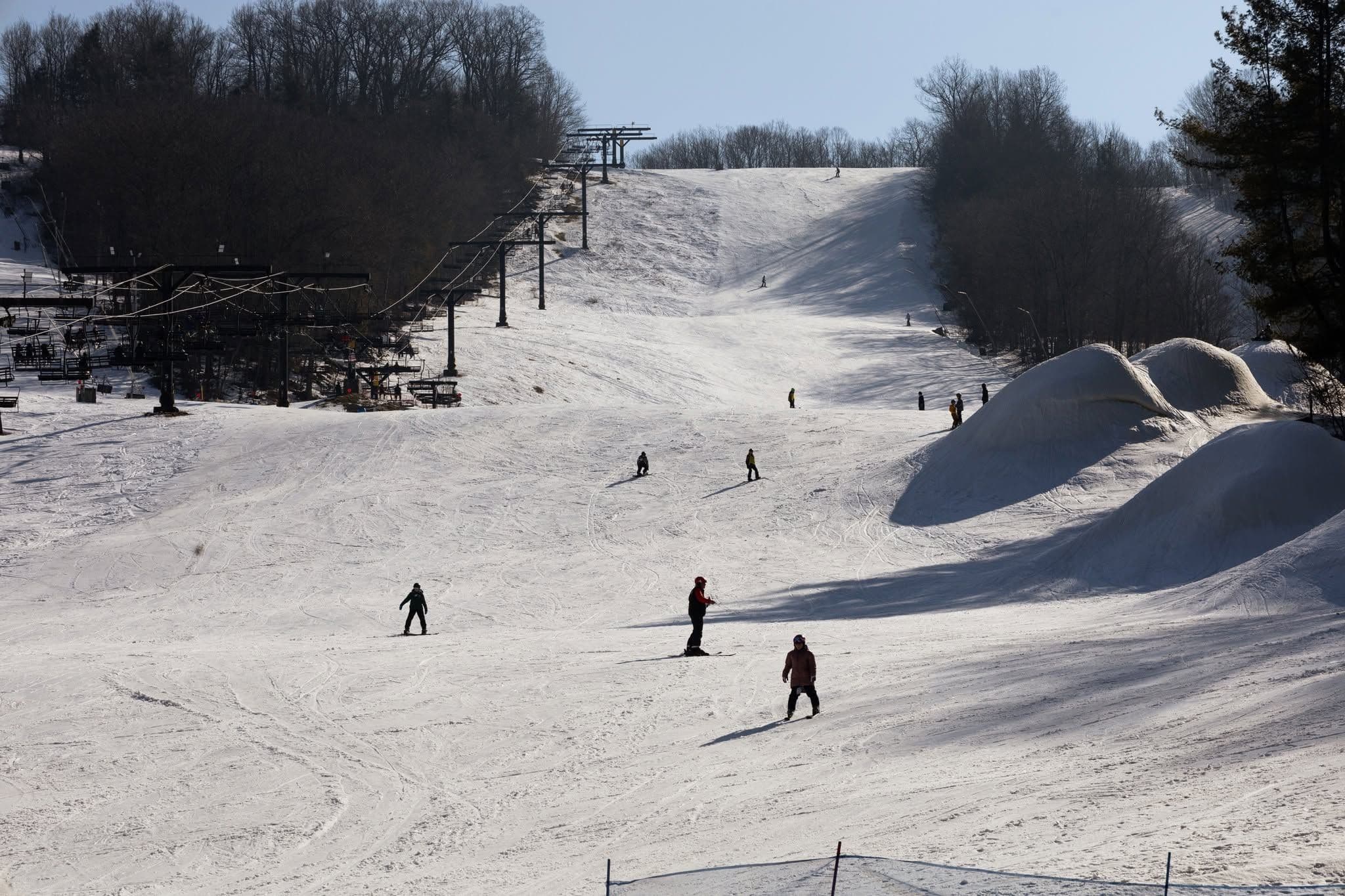
Click to expand • 4 total photos
Terrain & lifts
Resort-reported stats for Swain
Lifts
5
Skiable area
296.5 ac
Longest run
1.6 km / 1 mi
Runs by difficulty(35 total)
Beginner
11
32% of terrain
Intermediate
13
37% of terrain
Advanced
11
31% of terrain
Run counts estimated from resort-reported totals and terrain mix.
Lift fleet
- Quad chair3
- Double chair1
- Surface lift1
Snowmaking covers about 97% of terrain.
Resort Info
Season dates
Future dates are operator estimates and may change.
Ski passes
Indy Pass
Access tiers change by season — confirm benefits on the pass operator's site.
Top Après Ski
Shawmut Grille – Known for its welcoming atmosphere and classic après-ski fare, Shawmut Grille is a favorite among Swain visitors for its hearty food, local craft beers, and relaxed setting perfect for unwinding after a day on the slopes.
Not operating — not open yet
Projected to open December 19, 2026
SnowSure scores and forecasts below are for planning and reference only while the resort is closed.
Depth
Snowpack still building before opening — no base depth yet.
Recent
No new snow has been recorded in the past week.
Forecast
The 14-day snow outlook is currently unavailable, but monitoring conditions is advisable as the opening date approaches.
Historic
With no snow accumulation to date, it is too early to judge the season compared to the 5-year average to-date of 114cm.
Closed for the season · Data updated Sat, Jul 4, 04:05 PM UTC · informational only
Snow Summary
Updated Jul 4, 2026 at 4:05 PM
Historical data from Open-Meteo archive • Forecast from ECMWF IFS model
Snowfall Forecast Maps
Mid-Atlantic & Appalachians region
Current Conditions
Reported Sat, Jul 4, 04:05 PM UTC
Base
402m
Temp
24.9°C
Wind
12.6km/h
Snow Depth
--
14-Day Forecast
0cm
Mid-Mountain
502m
Temp
24.3°C
Wind
14km/h
Snow Depth
--
14-Day Forecast
0cm
Summit
601m
Temp
23.6°C
Wind
12.6km/h
Snow Depth
--
14-Day Forecast
0cm
Local Reports
0 reportsDaily Snowfall Forecast by Model
Black line = verified SnowSure™ blend (not a simple average). Weights update weekly from measured snowfall at SNOTEL stations and resort reports.
SnowSure™ blend — verified model weighting
The black line is not a simple average. For Swain (rockies), we combine seven global weather models using weights learned from daily forecast verification — comparing each model's prediction to measured snowfall (SNOTEL, resort reports, ERA5).
- 1.Horizon buckets: days 1–3, 4–7, and 8–14 each get separate weights — short-range skill differs from long-range.
- 2.Regional calibration: weights come from verified error in this geography (Rockies, Alps, Japan, etc.), recalculated weekly.
- 3.Ground truth only: we never grade a forecast against another model — only against measured snow.
Building verification history for this resort.
How we verify forecasts →Hourly Forecast Detail
AM / PM / Night breakdown with wind and freezing level
NWP models refresh up to 4× daily · Last synced Jul 4, 4:05 PM
Today 26 / 1913.2mm | Sun, Jul 5 24 / 185.1mm | Mon, Jul 6 22 / 189mm | Tue, Jul 7 23 / 171.2mm | Wed, Jul 8 27 / 161.2mm | Thu, Jul 9 27 / 195.1mm | |||||||||||||
|---|---|---|---|---|---|---|---|---|---|---|---|---|---|---|---|---|---|---|
| Period | AM | PM | Night | AM | PM | Night | AM | PM | Night | AM | PM | Night | AM | PM | Night | AM | PM | Night |
| Snow (cm) | 0 | 0 | 0 | 0 | 0 | 0 | 0 | 0 | 0 | 0 | 0 | 0 | 0 | 0 | 0 | 0 | 0 | 0 |
| Precip (mm) | 0.3 | 5.1 | 7.8 | 0.3 | 3 | 1.8 | 0.3 | 7.8 | 0.9 | 0.3 | 0.9 | 0 | 0.3 | 0.9 | 0 | 0 | 5.1 | 0 |
| Temp (°C) | 21 | 24 | 20 | 20 | 23 | 19 | 20 | 22 | 18 | 18 | 22 | 19 | 20 | 26 | 20 | 22 | 25 | 20 |
| Wind (km/h) | 13 | 12 | 11 | 3 | 6 | 4 | 6 | 7 | 6 | 6 | 9 | 8 | 6 | 5 | 7 | 16 | 14 | 16 |
| Gusts (km/h) | 30 | 34 | 24 | 10 | 19 | 11 | 13 | 19 | 14 | 15 | 22 | 19 | 16 | 18 | 19 | 24 | 26 | 22 |
14-Day Snow Forecast by Model
Summit elevation (601m)
10-Day Forecast
Today
4
🌦️
26.1°
19.1°
26 km/h
Sun
5
🌧️
23.5°
18.1°
7 km/h
Mon
6
🌦️
22.3°
17.5°
10 km/h
Tue
7
🌧️
22.9°
16.6°
11 km/h
Wed
8
🌧️
26.6°
16.1°
14 km/h
Thu
9
⛈️
26.8°
18.7°
18 km/h
Fri
10
🌧️
23.6°
18.1°
21 km/h
Sat
11
🌧️
22.6°
18.2°
11 km/h
Sun
12
🌧️
24.9°
16.3°
8 km/h
Mon
13
🌧️
20.8°
15.9°
11 km/h
Summit elevation (601m) • ECMWF model
Season vs Historic
Updated Sat, Jul 4, 04:05 PM UTC
0cm
Season Total
This Season to Date
—
vs 5-Year Avg
Off-season · 114cm full-season avg
—
vs 30-Year Avg
Off-season · 114cm full-season avg
114cm
5-Yr Avg by Now
Over the past five years, average seasonal snowfall has declined compared to the 30-year average, with the 5-year mean at 126.2 cm versus the long-term average of 142.7 cm. The most recent season recorded 119.9 cm, which is slightly below both the 5-year and 30-year averages, continuing a pattern of generally lower snowfall in recent years. Notably, snowfall has fluctuated significantly within this period, ranging from a high of 158.2 cm in 2021 to a low of 105.4 cm in 2023, indicating increased variability. Overall, the data suggests a downward trend in snowfall with heightened year-to-year variability and occasional anomalies.
Swain Snow History
Average annual snowfall is 143cm with an average of 89 snowfall days per season. The table below shows monthly averages across 30 seasons of archive data (modeled snowpack at mid-elevation).
| Month | Avg Snowfall | Snowfall Days | Avg Base Depth | Max Base Depth | Biggest Snowfall |
|---|---|---|---|---|---|
| November | 15.2cm | 10 days | 2cm | 9cm | 4.7cm |
| December | 28.8cm | 18 days | 9cm | 18cm | 6.8cm |
| January | 32.6cm | 21 days | 15cm | 28cm | 7.5cm |
| February | 28.6cm | 17 days | 20cm | 32cm | 8.2cm |
| March | 24.7cm | 13 days | 13cm | 27cm | 7.8cm |
| April | 10.9cm | 7 days | 2cm | 10cm | 4.8cm |
| May | 0.6cm | 1 days | 0cm | 2cm | 1.2cm |
Source: SnowSure archive · Open-Meteo ERA5 reanalysis at mid-elevation. Depth is modeled, not resort-reported.
Season at a Glance
Next season(2026-27)
Opens Dec 19, 2026
Multi-season averages will appear once SnowSure has tracked more than one full season.
Best Months to Visit
February
Peak Season
January
Peak Season
March
Good
December
Good
Note: Based on typical ski season patterns for this region.


