
📷 Mt Baw Baw
Oceania
Mt Baw Baw
Limited
→stable
Scroll for happiness
Last Snowfall
Jul 23
2d agoPast 24 Hours
0cm
Past 48 Hours
0.1cm
Past 10 Days
1.4cm
14-Day Forecast
11.4cm
Snow Depth
0cm
Overview
Mt Baw Baw is a ski resort in Oceania, Australia. Today's SnowSure™ Score is 15/100 (Limited), 1 cm (0.4 in) of snow in the last 7 days. The 14-day ensemble forecast across seven weather models (ECMWF, GFS, GEM, JMA, ICON, Météo-France, Met Norway) calls for ~11 cm (4.3 in) of new snow. Conditions last updated 2026-07-25 23:09 UTC.
Resort Guide
Mt Baw Baw Alpine Resort is located in Victoria, Australia, within the Baw Baw National Park and is the closest alpine resort to Melbourne. The resort features 35 hectares of skiable terrain, catering primarily to beginners and families with gentle slopes and a relaxed, friendly atmosphere. Key amenities include ski and snowboard rentals, snow play areas, toboggan runs, and a range of accommodation and dining options. Mt Baw Baw stands out for its accessible location, family-friendly environment, and opportunities for snow activities beyond skiing, such as snowshoeing and husky sled dog tours.
Gallery
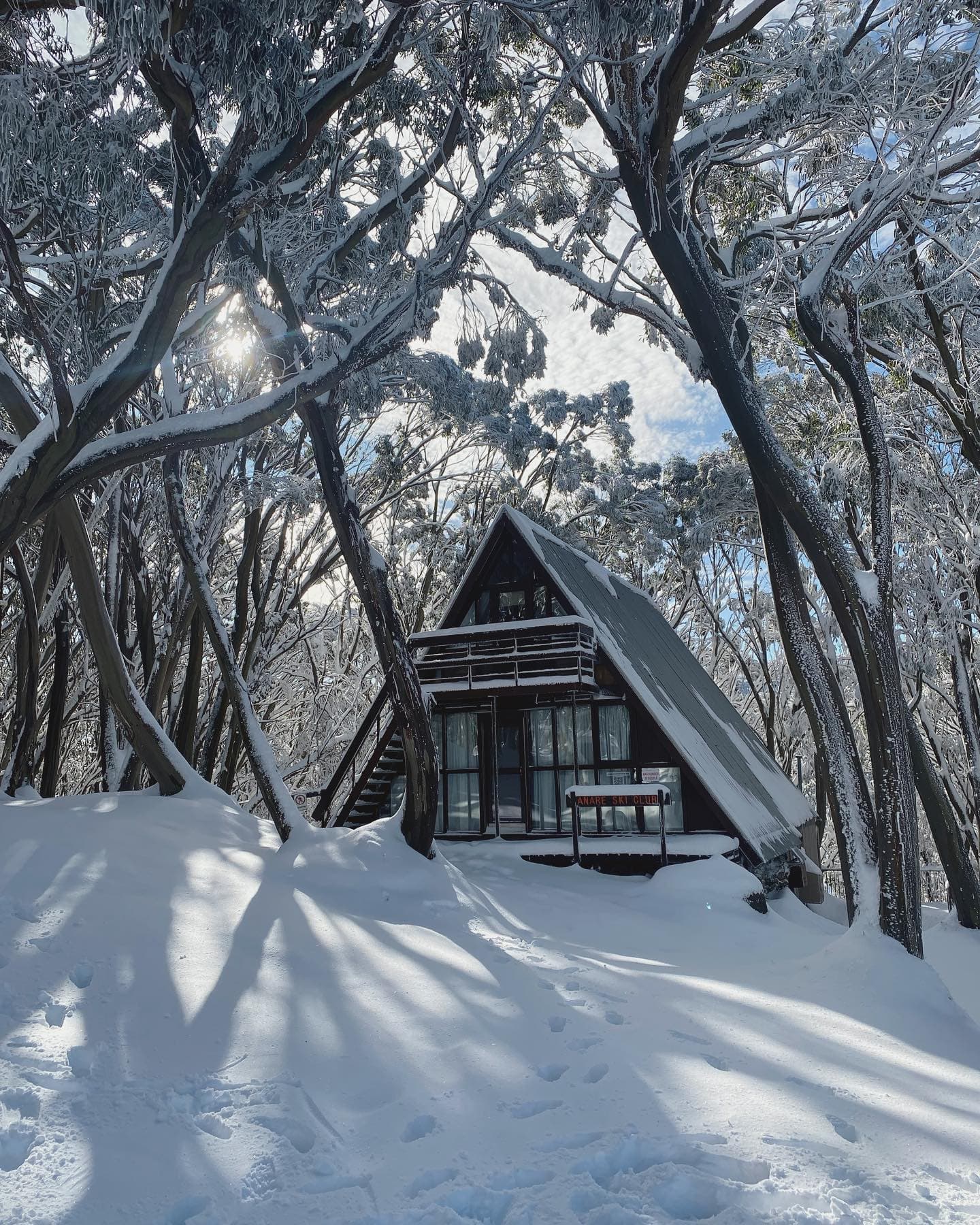
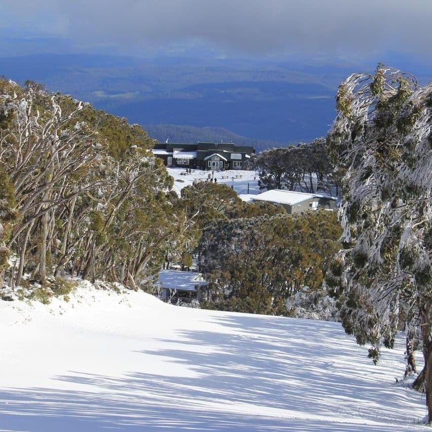
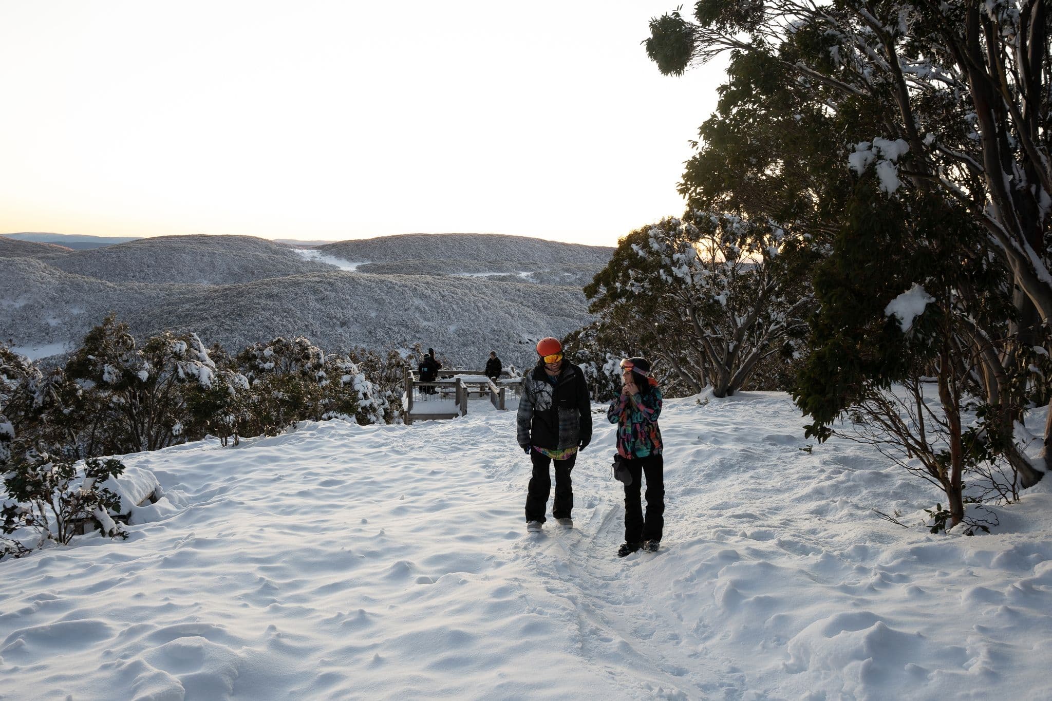
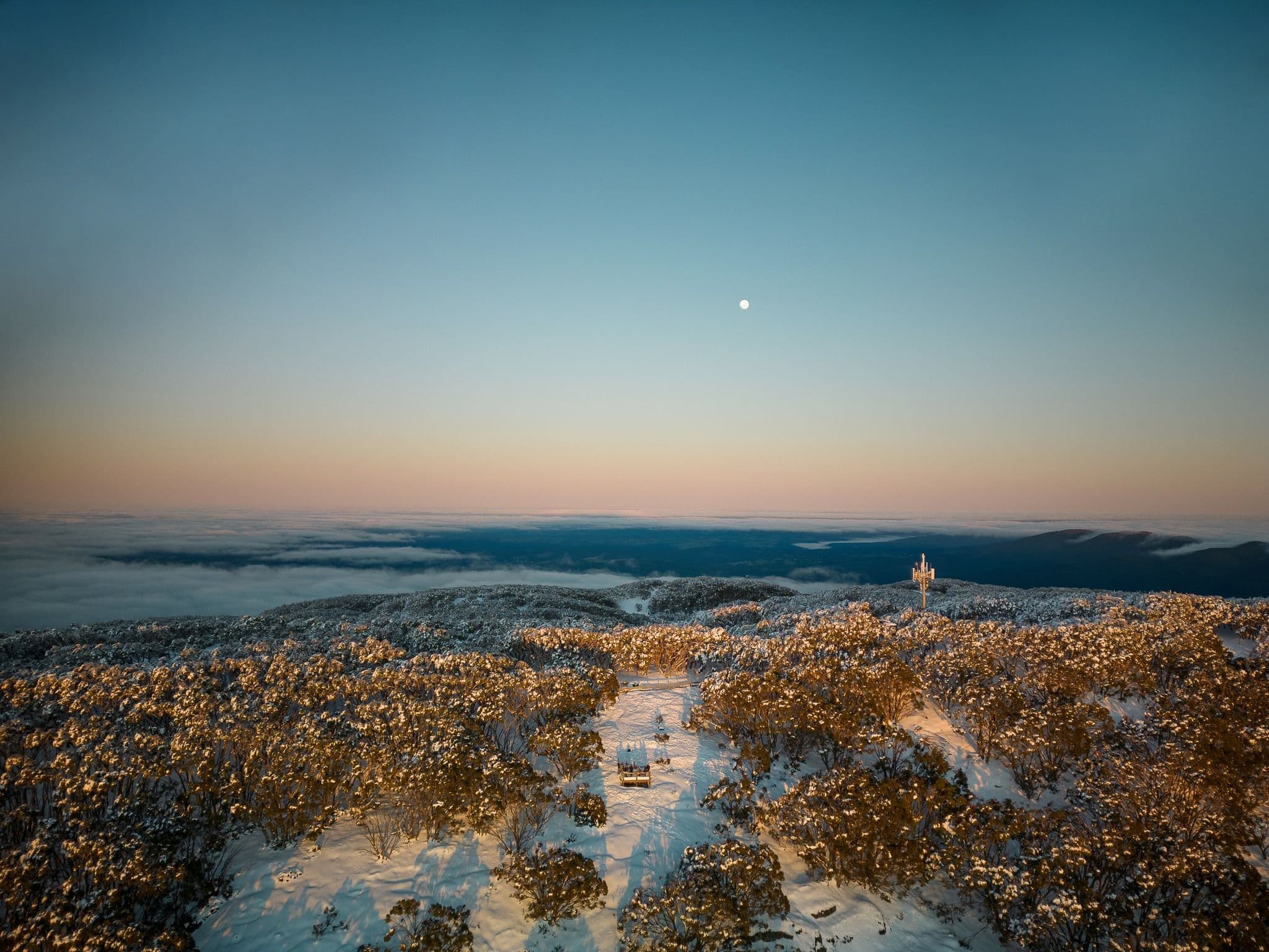
Click to expand • 5 total photos
Terrain & lifts
Resort-reported stats for Mt Baw Baw
Lifts
7
Skiable area
86 ac
Longest run
1 km / 0.62 mi
Runs by difficulty(15 total)
Beginner
4
25% of terrain
Intermediate
9
64% of terrain
Advanced
2
11% of terrain
Run counts estimated from resort-reported totals and terrain mix.
Lift fleet
- Surface lift7
Resort Info
Season dates
Future dates are operator estimates and may change.
Ski passes
No ski pass found
Access tiers change by season — confirm benefits on the pass operator's site.
Top Après Ski
Village Central Restaurant & Bar – Known as the heart of Mt Baw Baw’s après-ski scene, this venue offers panoramic mountain views, a cozy atmosphere, and a selection of local wines and craft beers, making it a popular spot for unwinding after a day on the slopes.
Limited conditions.
As we enter the early season at Mt Baw Baw, recent light snow has contributed to a limited base. The forecast suggests a mix of conditions ahead, with some additional snowfall expected in the coming weeks.
Depth
Thin base so far — normal at the very start of the season.
Recent
In the past week, 1cm of snow has been recorded.
Forecast
The 14-day snow outlook indicates potential accumulation between 11cm and 24cm.
Historic
Season-to-date snowfall is tracking below typical for this point in the season, with 6cm compared to the 5-year average of 20cm.
Data updated Sat, Jul 25, 11:09 PM UTC
Snow Summary
Updated Jul 25, 2026 at 11:09 PM
Historical data from Open-Meteo archive • Forecast from ECMWF IFS model
Snowfall Forecast Maps
Australia & Tasmania region
Current Conditions
Reported Sat, Jul 25, 11:09 PM UTC
Depth by source
every reading we have- Resort ReportedBase 0cm
The headline depth uses the most trusted available source. We show every reading so you can judge for yourself.
Freezing Level
1672m
☀️ Above summit - warm/wet conditions
Base
1450m
Temp
1.4°C
Wind
11.2km/h
Snow Depth
0cm
Resort reported
14-Day Forecast
11.7cm
Mid-Mountain
1507m
Temp
--°C
Wind
12km/h
Snow Depth
0cm
Resort reported
14-Day Forecast
11.4cm
Summit
1564m
Temp
0.7°C
Wind
11.2km/h
Snow Depth
0cm
Resort reported
14-Day Forecast
12.5cm
Ops signals
- ●Freezing level above summit — rain risk at lower elevations
Lifts Open
open
Runs Open
open
Live Conditions
Mt Baw Baw Webcams
Mt Baw Baw
Mt Baw Baw
Mt Baw Baw
Mt Baw Baw
Mt Baw Baw
Mt Baw Baw
Local Reports
0 reportsDaily Snowfall Forecast by Model
Black line = verified SnowSure™ blend (not a simple average). Weights update weekly from measured snowfall at SNOTEL stations and resort reports.
SnowSure™ blend — verified model weighting
The black line is not a simple average. For Mt Baw Baw (southern alps), we combine seven global weather models using weights learned from daily forecast verification — comparing each model's prediction to measured snowfall (SNOTEL, resort reports, ERA5).
- 1.Horizon buckets: days 1–3, 4–7, and 8–14 each get separate weights — short-range skill differs from long-range.
- 2.Regional calibration: weights come from verified error in this geography (Rockies, Alps, Japan, etc.), recalculated weekly.
- 3.Ground truth only: we never grade a forecast against another model — only against measured snow.
Building verification history for this resort.
How we verify forecasts →Hourly Forecast Detail
AM / PM / Night breakdown with wind and freezing level
NWP models refresh up to 4× daily · Last synced Jul 25, 11:09 PM
Sun, Jul 26 4 / -10.1cm1mm | Mon, Jul 27 4 / -1 | Tue, Jul 28 1 / -23.7cm5.8mm | Wed, Jul 29 -1 / -47.8cm11.2mm | Thu, Jul 30 1 / -31.3cm1.9mm | Fri, Jul 31 6 / -4 | |||||||||||||
|---|---|---|---|---|---|---|---|---|---|---|---|---|---|---|---|---|---|---|
| Period | AM | PM | Night | AM | PM | Night | AM | PM | Night | AM | PM | Night | AM | PM | Night | AM | PM | Night |
| Snow (cm) | 0 | 0 | 0.1 | 0 | 0 | 0 | 0.3 | 0.1 | 3.3 | 2.9 | 1.8 | 3.1 | 0.4 | 0.4 | 0.5 | 0 | 0 | 0 |
| Precip (mm) | 0.1 | 0.2 | 0.7 | 0 | 0 | 0 | 0.4 | 0.6 | 4.8 | 4.2 | 2.6 | 4.4 | 0.6 | 0.6 | 0.7 | 0 | 0 | 0 |
| Temp (°C) | 1 | 4 | 0 | 0 | 3 | -1 | -1 | 1 | 0 | -3 | -2 | -3 | -2 | 0 | -2 | -1 | 5 | -2 |
| Wind (km/h) | 11 | 11 | 8 | 6 | 12 | 12 | 20 | 24 | 22 | 13 | 13 | 15 | 6 | 9 | 5 | 1 | 2 | 3 |
| Gusts (km/h) | 34 | 33 | 27 | 21 | 37 | 35 | 65 | 78 | 70 | 51 | 48 | 53 | 32 | 26 | 27 | 21 | 19 | 15 |
14-Day Snow Forecast by Model
Summit elevation (1564m)
10-Day Forecast
Sun
26
🌧️
4.1°
-1.1°
12 km/h
Mon
27
☁️
3.6°
-1.5°
21 km/h
Tue
28
🌧️
1.2°
-1.7°
26 km/h
Wed
29
❄️
-1.5°
-4.2°
9.8cm
21 km/h
Thu
30
🌧️
0.5°
-3°
2.4cm
10 km/h
Fri
31
☁️
5.7°
-4.2°
5 km/h
Sat
1
☁️
4.1°
-5.3°
18 km/h
Sun
2
☁️
3.9°
-3°
13 km/h
Mon
3
☁️
5.6°
-3.4°
9 km/h
Tue
4
🌧️
4.2°
-3°
14 km/h
Summit elevation (1564m) • ECMWF model
Season vs Historic
Updated Sat, Jul 25, 11:09 PM UTC
6.2cm
Season Total
This Season to Date
-69%
vs 5-Year Avg
20cm avg by now
-69%
vs 30-Year Avg
20cm avg by now
20cm
5-Yr Avg by Now
Over the past five years, average seasonal snowfall has increased significantly, with the 5-year average (16.3 cm) more than triple the 30-year average (5.0 cm). The current season's snowfall is 137% of the recent 5-year average and 446% of the long-term average, indicating a substantial anomaly compared to historical norms. Notably, snowfall has been highly variable, with a sharp drop in 2023 (1.5 cm) followed by a strong rebound in 2024 (5.3 cm), suggesting increased volatility in recent years.
Mt Baw Baw Snow History
Average annual snowfall is 25cm with an average of 16 snowfall days per season. The table below shows monthly averages across 31 seasons of archive data (modeled snowpack at mid-elevation).
| Month | Avg Snowfall | Snowfall Days | Avg Base Depth | Max Base Depth | Biggest Snowfall |
|---|---|---|---|---|---|
| June | 3.4cm | 2 days | 0cm | 2cm | 2.7cm |
| July | 5.6cm | 4 days | 0cm | 2cm | 3.4cm |
| August | 9.1cm | 5 days | 0cm | 3cm | 4.4cm |
| September | 5cm | 3 days | 0cm | 2cm | 3.2cm |
| October | 0.9cm | 1 days | 0cm | 2cm | 1cm |
Source: SnowSure archive · Open-Meteo ERA5 reanalysis at mid-elevation. Depth is modeled, not resort-reported.
Season at a Glance
Next season(2026)
Opens Jun 26, 2026
Through Sep 27, 2026
Multi-season averages will appear once SnowSure has tracked more than one full season.
Best Months to Visit
August
Peak Season
July
Peak Season
September
Good
June
Good
Note: Based on typical ski season patterns for this region.


