
📷 Ōhau
Oceania
Ōhau
Limited
→stable
Scroll for happiness
Last Snowfall
Jul 17
Past 24 Hours
0.2cm
Reported by ŌhauPast 48 Hours
4.3cm
Past 10 Days
41.6cm
14-Day Forecast
20.7cm
Snow Depth
50cm
Powder Days
2
2026 season
Overview
Ōhau is a ski resort in Oceania, New Zealand. Today's SnowSure™ Score is 14/100 (Limited), snow base 50 cm (19.7 in), 28 cm (11 in) of snow in the last 7 days. The 14-day ensemble forecast across seven weather models (ECMWF, GFS, GEM, JMA, ICON, Météo-France, Met Norway) calls for ~21 cm (8.3 in) of new snow. Conditions last updated 2026-07-16 20:04 UTC.
Resort Guide
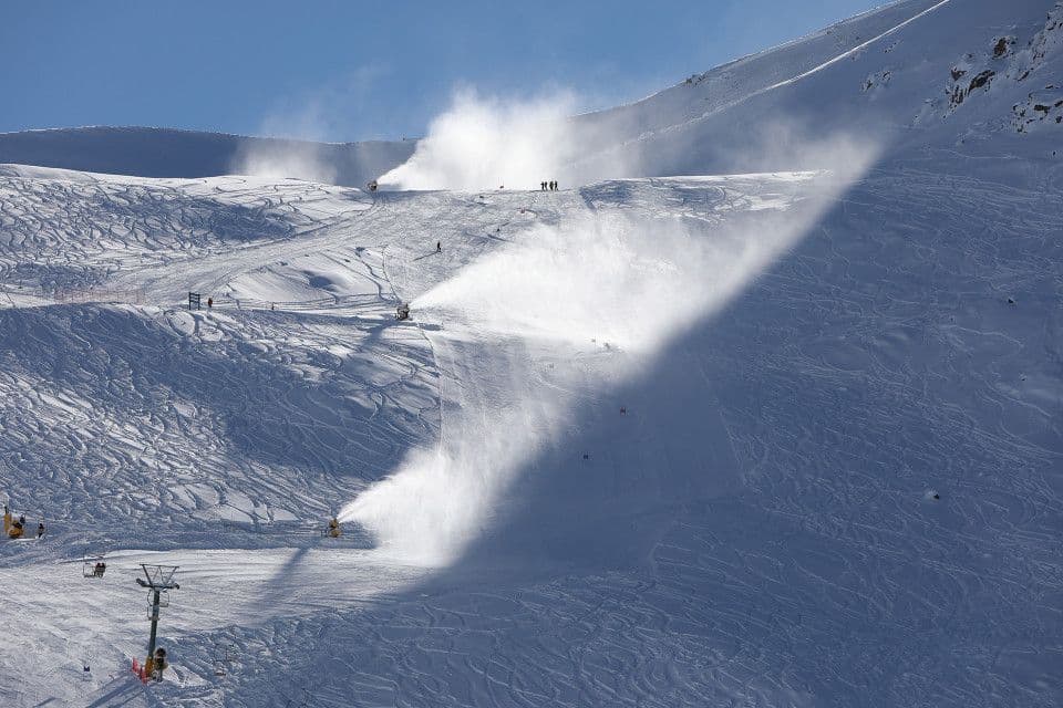
Ōhau Snow Fields is located in the Southern Alps of New Zealand, between Christchurch and Queenstown, offering panoramic views over Lake Ōhau. The resort features a relaxed, friendly atmosphere with uncrowded slopes, catering to skiers and snowboarders of all abilities across 125 hectares of skiable terrain. Signature experiences include wide-open groomed runs, powder bowls, and a renowned learners’ area, complemented by the on-mountain Ōhau Lodge providing accommodation, dining, and après-ski amenities. The resort stands out for its natural alpine setting, welcoming vibe, and exceptional lake and mountain vistas.
Gallery
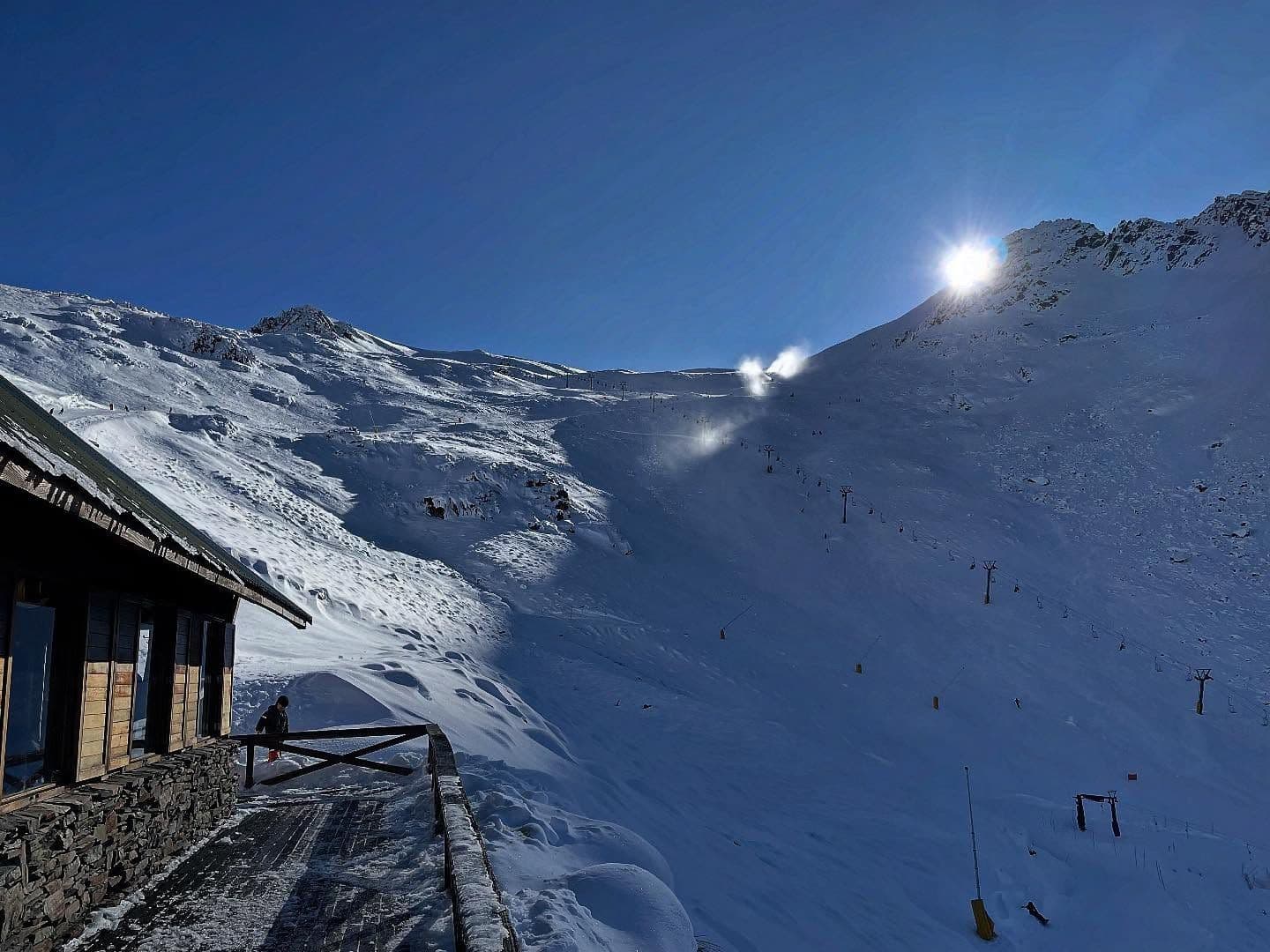
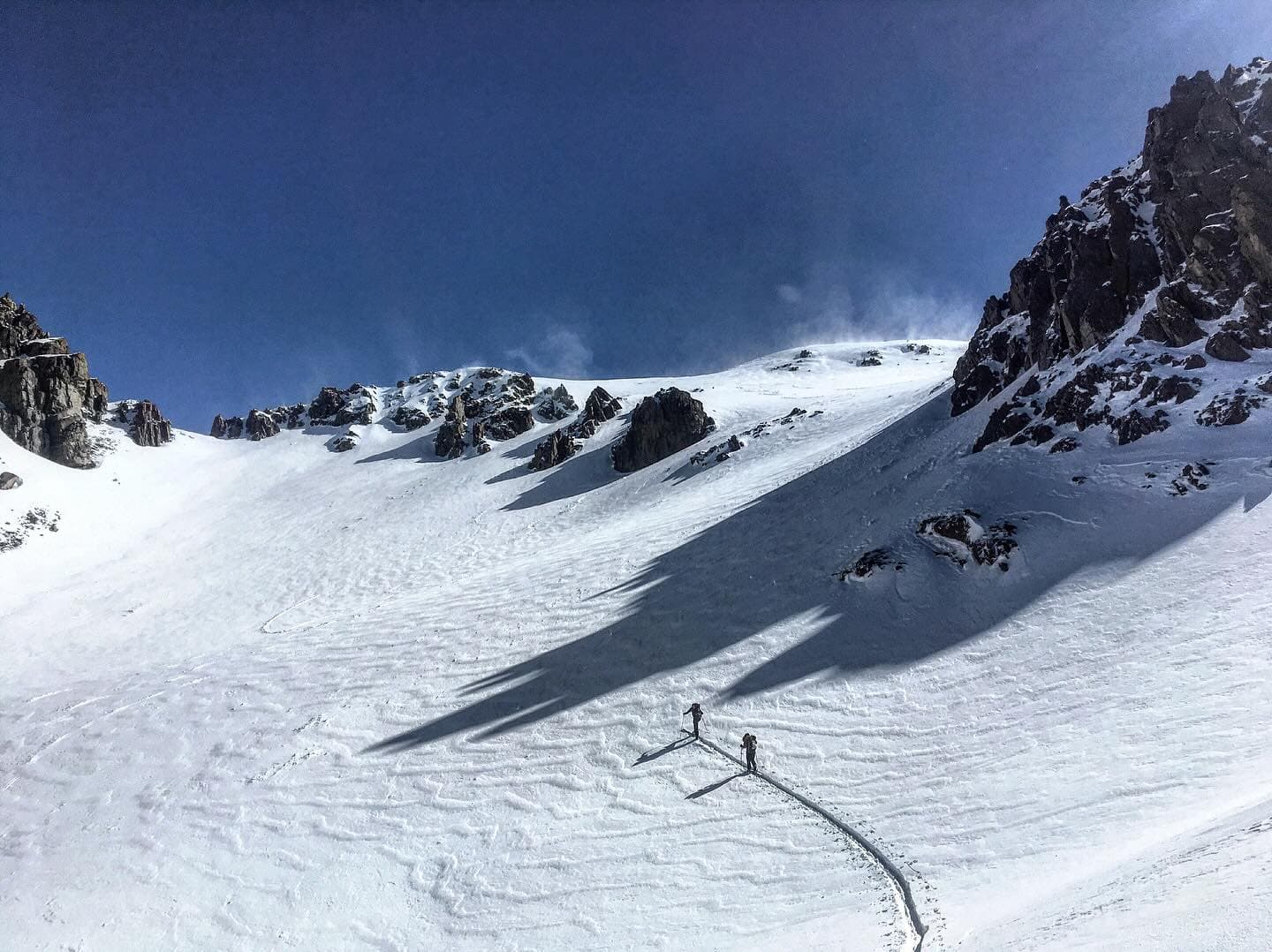
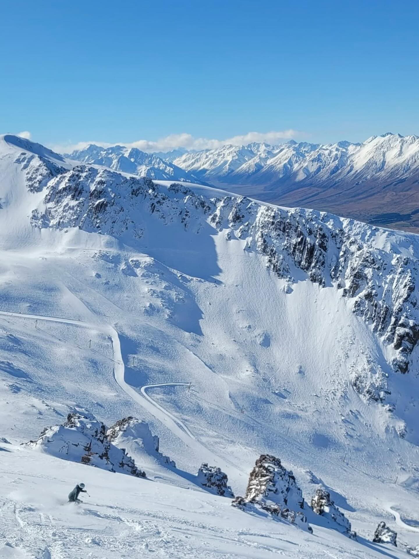
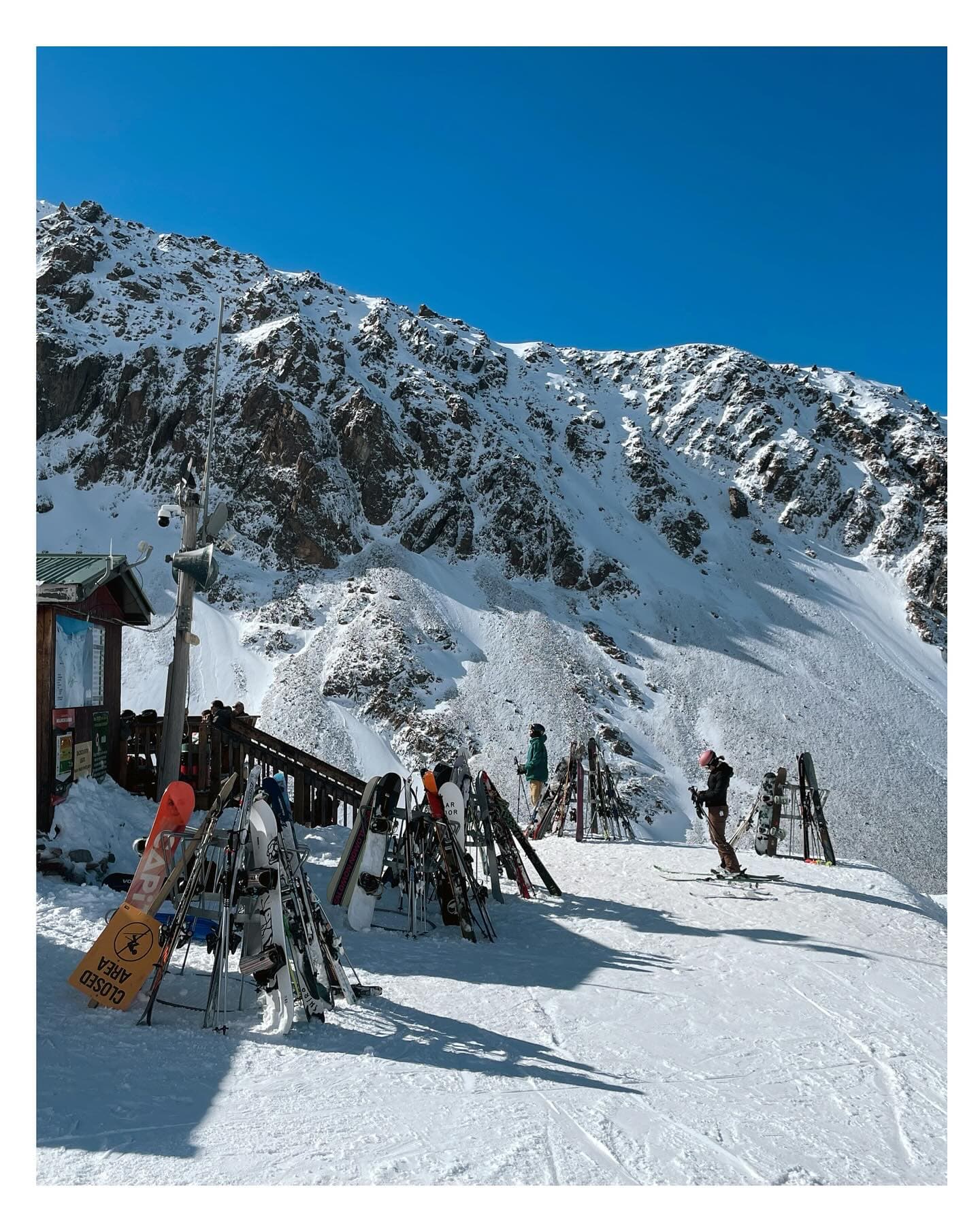
Click to expand • 6 total photos
Terrain & lifts
Resort-reported stats for Ōhau
Lifts
3
Skiable area
308.9 ac
Longest run
2.5 km / 1.6 mi
Resort Info
Season dates
Future dates are operator estimates and may change.
Top Après Ski
The Lodge at Lake Ohau – Renowned for its cozy lounge and bar, this venue offers a welcoming après-ski atmosphere with stunning lake and mountain views, hearty meals, and a convivial setting where skiers gather to unwind by the fire after a day on the slopes.
Adequate snow - check forecasts before booking.
Current conditions at Ōhau are partly cloudy with a temperature of -11°C and a snow depth of 50cm. Over the past week, the resort received 28cm of fresh snow, contributing to a season total of 67cm. The next 14 days are expected to bring between 21cm and 37cm of additional snowfall, depending on the forecast model.
AI-generated summaryDepth
50cm depth — upper mountain may be better.
Recent
In the last week, 28cm of snow has fallen, with 4cm in the past 48 hours.
Forecast
The 14-day outlook predicts an average of 21cm to 37cm of new snow.
Historic
So far this season, Ōhau has received 67cm of snow, which is about 65% of the 5-year average of 103cm for this time of year.
Data updated Thu, Jul 16, 08:04 PM UTC
Snow Summary
Updated Jul 16, 2026 at 8:04 PM
Historical data from Open-Meteo archive • Forecast from ECMWF IFS model
Snowfall Forecast Maps
New Zealand region
Current Conditions
Reported Thu, Jul 16, 08:04 PM UTC
Depth by source
every reading we have- Resort ReportedBase 50cm · Mid 50cm · Summit 50cm
- Open-MeteoBase 15cm · Summit 15cm
The headline depth uses the most trusted available source. We show every reading so you can judge for yourself.
Freezing Level
256m
❄️ Below base - cold & dry snow expected
Base
1425m
Temp
-7.6°C
Wind
11.1km/h
Snow Depth
50cm
Resort reported
Resort 50cm · Model 15cm
14-Day Forecast
21.6cm
Mid-Mountain
1677m
Temp
-9.2°C
Wind
12km/h
Snow Depth
50cm
Resort reported
14-Day Forecast
20.7cm
Summit
1929m
Temp
-10.8°C
Wind
11.1km/h
Snow Depth
50cm
Resort reported
Resort 50cm · Model 15cm
14-Day Forecast
34.5cm
Ops signals
- ●Freezing level below base — snowmaking window open
- ●Cold summit temps — snow preservation favorable
Lifts Open
open
Live Conditions
Ōhau Webcams
Ōhau Snow Fields
Ōhau Snow Fields
Ōhau Snow Fields
Ōhau Snow Fields
Ōhau Snow Fields
Local Reports
0 reportsDaily Snowfall Forecast by Model
Black line = verified SnowSure™ blend (not a simple average). Weights update weekly from measured snowfall at SNOTEL stations and resort reports.
SnowSure™ blend — verified model weighting
The black line is not a simple average. For Ōhau (southern alps), we combine seven global weather models using weights learned from daily forecast verification — comparing each model's prediction to measured snowfall (SNOTEL, resort reports, ERA5).
- 1.Horizon buckets: days 1–3, 4–7, and 8–14 each get separate weights — short-range skill differs from long-range.
- 2.Regional calibration: weights come from verified error in this geography (Rockies, Alps, Japan, etc.), recalculated weekly.
- 3.Ground truth only: we never grade a forecast against another model — only against measured snow.
Building verification history for this resort.
How we verify forecasts →Hourly Forecast Detail
AM / PM / Night breakdown with wind and freezing level
NWP models refresh up to 4× daily · Last synced Jul 16, 8:04 PM
Fri, Jul 17 -2 / -12 | Sat, Jul 18 -1 / -30.6cm0.9mm | Sun, Jul 19 -1 / -4 | Mon, Jul 20 -2 / -90.7cm0.9mm | Tue, Jul 21 -1 / -10 | Wed, Jul 22 -1 / -10 | |||||||||||||
|---|---|---|---|---|---|---|---|---|---|---|---|---|---|---|---|---|---|---|
| Period | AM | PM | Night | AM | PM | Night | AM | PM | Night | AM | PM | Night | AM | PM | Night | AM | PM | Night |
| Snow (cm) | 0 | 0 | 0 | 0.1 | 0.4 | 0.1 | 0 | 0 | 0 | 0.3 | 0 | 0.4 | 0 | 0 | 0 | 0 | 0 | 0 |
| Precip (mm) | 0 | 0 | 0 | 0.2 | 0.6 | 0.1 | 0 | 0 | 0 | 0.4 | 0 | 0.5 | 0 | 0 | 0 | 0 | 0 | 0 |
| Temp (°C) | -9 | -2 | -6 | -3 | -1 | -2 | -2 | -2 | -3 | -4 | -3 | -5 | -7 | -2 | -8 | -3 | -1 | -5 |
| Wind (km/h) | 11 | 8 | 8 | 8 | 8 | 8 | 4 | 2 | 4 | 2 | 2 | 2 | 7 | 7 | 5 | 5 | 5 | 5 |
| Gusts (km/h) | 36 | 38 | 33 | 43 | 53 | 45 | 20 | 15 | 19 | 12 | 10 | 15 | 22 | 22 | 21 | 30 | 28 | 29 |
14-Day Snow Forecast by Model
Summit elevation (1929m)
10-Day Forecast
Fri
17
⛅
-1.8°
-11.9°
11 km/h
Sat
18
🌧️
-1.3°
-3.1°
0.6cm
9 km/h
Sun
19
☁️
-1.1°
-3.9°
6 km/h
Mon
20
🌧️
-2.5°
-9.3°
0.5cm
5 km/h
Tue
21
☁️
-0.9°
-10.2°
7 km/h
Wed
22
☁️
-0.7°
-10.4°
8 km/h
Thu
23
❄️
-1.8°
-3.7°
12.2cm
6 km/h
Fri
24
🌧️
-3.8°
-5.1°
0.6cm
9 km/h
Sat
25
❄️
-2.1°
-6°
2.2cm
9 km/h
Sun
26
🌧️
-5.1°
-11°
0.4cm
4 km/h
Summit elevation (1929m) • ECMWF model
Season vs Historic
Updated Thu, Jul 16, 08:04 PM UTC
67.1cm
Season Total
This Season to Date
-35%
vs 5-Year Avg
103cm avg by now
-35%
vs 30-Year Avg
103cm avg by now
103cm
5-Yr Avg by Now
Snowfall over the past five years has averaged 123.9 cm, significantly exceeding the 30-year average of 75.4 cm, indicating a marked upward trend in recent seasons. The current season's snowfall is 59% of the recent 5-year average but nearly matches the 30-year average at 97%, suggesting a notable decrease compared to the recent high-snowfall period. This points to increased variability, with the current season representing a return to longer-term norms after several above-average years.
Ōhau Snow History
Average annual snowfall is 233cm with an average of 71 snowfall days per season. The table below shows monthly averages across 31 seasons of archive data (modeled snowpack at mid-elevation).
| Month | Avg Snowfall | Snowfall Days | Avg Base Depth | Max Base Depth | Biggest Snowfall |
|---|---|---|---|---|---|
| June | 35.7cm | 12 days | 14cm | 27cm | 13.2cm |
| July | 47.9cm | 14 days | 29cm | 41cm | 13.8cm |
| August | 44.5cm | 15 days | 37cm | 48cm | 13.9cm |
| September | 52.8cm | 14 days | 23cm | 41cm | 15cm |
| October | 40.4cm | 12 days | 7cm | 24cm | 14.9cm |
Source: SnowSure archive · Open-Meteo ERA5 reanalysis at mid-elevation. Depth is modeled, not resort-reported.
Season at a Glance
Next season(2026)
Opens Jun 27, 2026
Through Oct 4, 2026
Multi-season averages will appear once SnowSure has tracked more than one full season.
Best Months to Visit
August
Peak Season
July
Peak Season
September
Good
June
Good
Note: Based on typical ski season patterns for this region.


