Late-September North Atlantic System
1 resort in the path, 2cm at the biggest. Likely — the models agree on this one.
+2CM
Predicted at Stryn
0–8cm, models far apart
Storm
Sep 23–26
1 resort in the path
Peak
Sep 24
2cm at Stryn
Predicted
2cm
Stryn · 0–8cm, models far apart
Confidence
Likely
Updated
Sep 13, 18:30 UTC
SnowSure Forecaster
Written from the blend and the model spread · updated Sep 13, 18:30 UTC
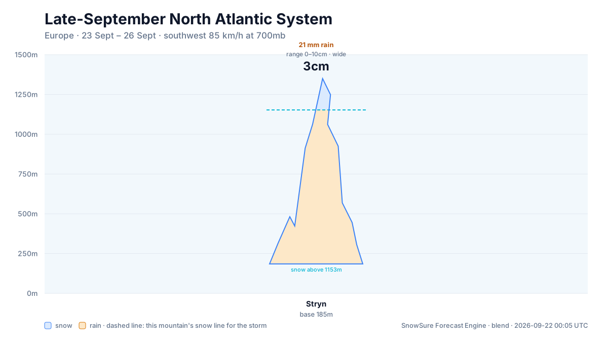
We are watching a significant system for the Alps and wider Europe between 2026-09-23 and 2026-09-26. Stryn carries the biggest signal at 2.3cm over 2026-09-23 to 2026-09-26. At Stryn the freezing level on the snow days sits above the summit, so treat those totals with caution. The call changes if model agreement loosens, the window slides later, or the freezing level trends higher.
Snow by day
Sep 22 – Sep 27, with a day either side. For each resort: where the freeze line sits against the mountain, then what falls — snow in cm, rain in mm — and the day read from those two numbers.
Strynbase 185 m · summit 1,350 m
2cm snow23mm rain
Modelled at the summit, 1,350 m · rain on the whole mountain
linem
/ raincm · mm
Tue
Sep 22
Rain
Wed
Sep 23
Rain
Thu
Sep 24
Mixed
Fri
Sep 25
Rain
Sat
Sep 26
Rain
Sun
Sep 27
Rain
rain low, snow high Thu · rain Wed, Fri, Sat
snowrain low, snow highraindryThe dots are the freeze line — the height where rain turns to snow. Solid: straight from the models. Hollow: estimated from temperature. Above the summit line it rains on the whole mountain; below the base line it snows all the way down. Blue bars are snow in cm, amber bars rain in mm; the totals above are their sums.
Rain / snow line
Base to summit for each mountain, with the snow line cut across them.

The system
700mb flow — where the storm is, and what is steering it. Pins sized by forecast total.
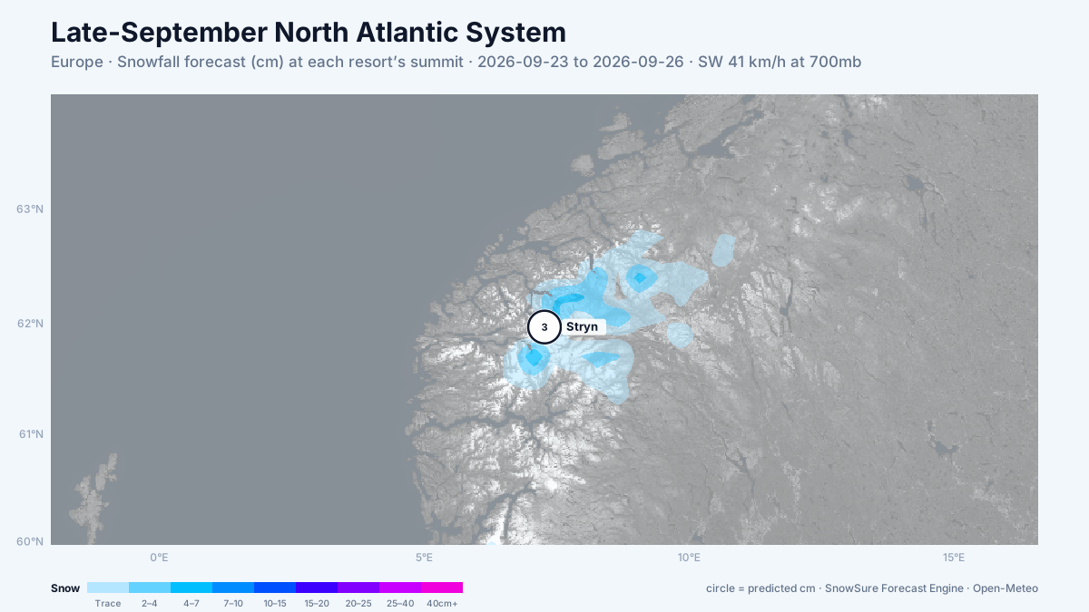
72-hour snowfall forecast for the same window.

In the path
Forecast, not observation — none of this has fallen yet. Totals are across the window. We will post what fell when the window closes.
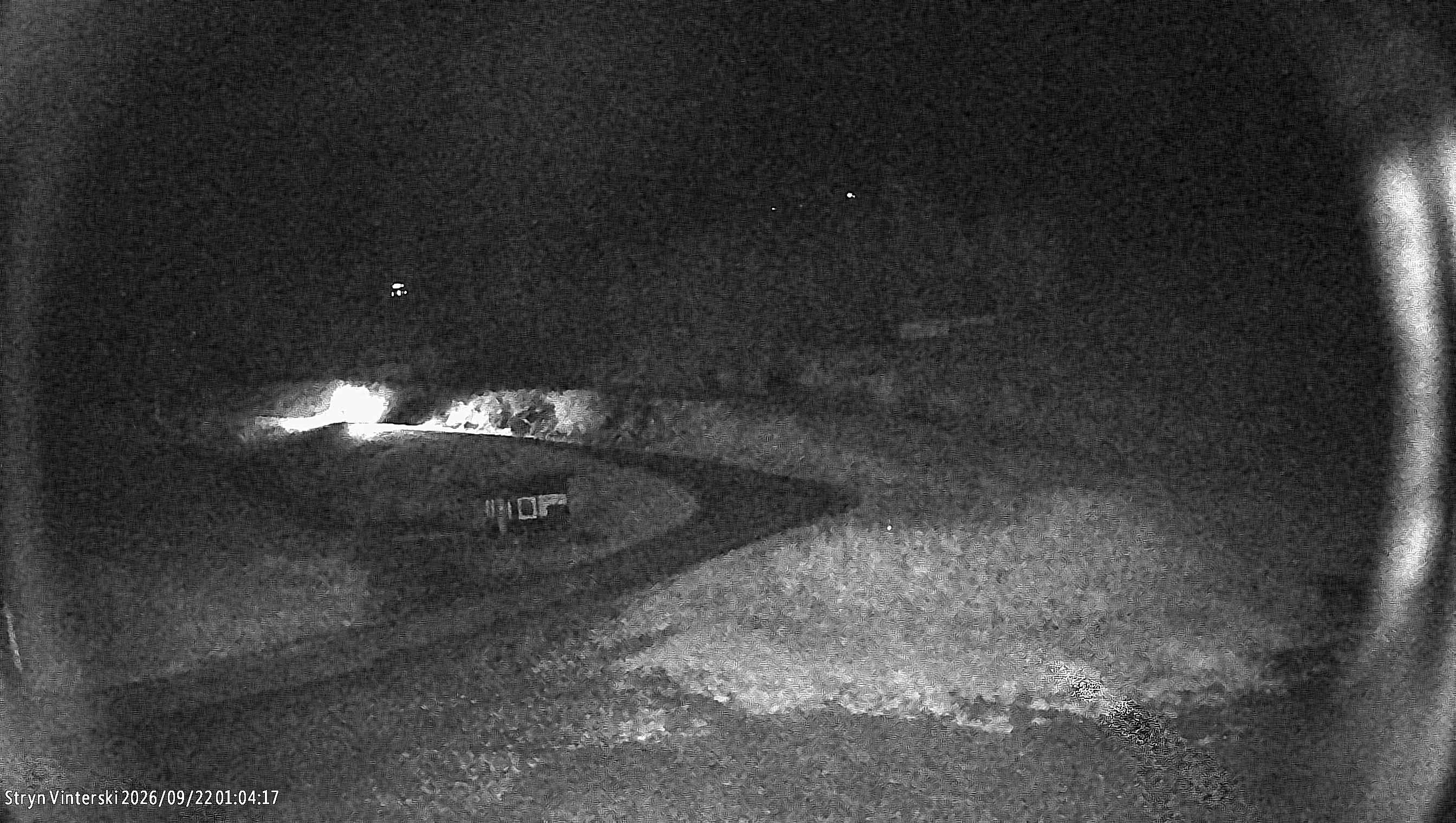
Last updated 2026-09-13 18:30 UTC. SnowSure scans a blend of seven weather models twice daily and flags systems clearing 30cm over 72 hours, three to fourteen days out. This watch opened on 2026-09-13 with 39cm forecast at Stryn.


