
📷 Corralco
South America
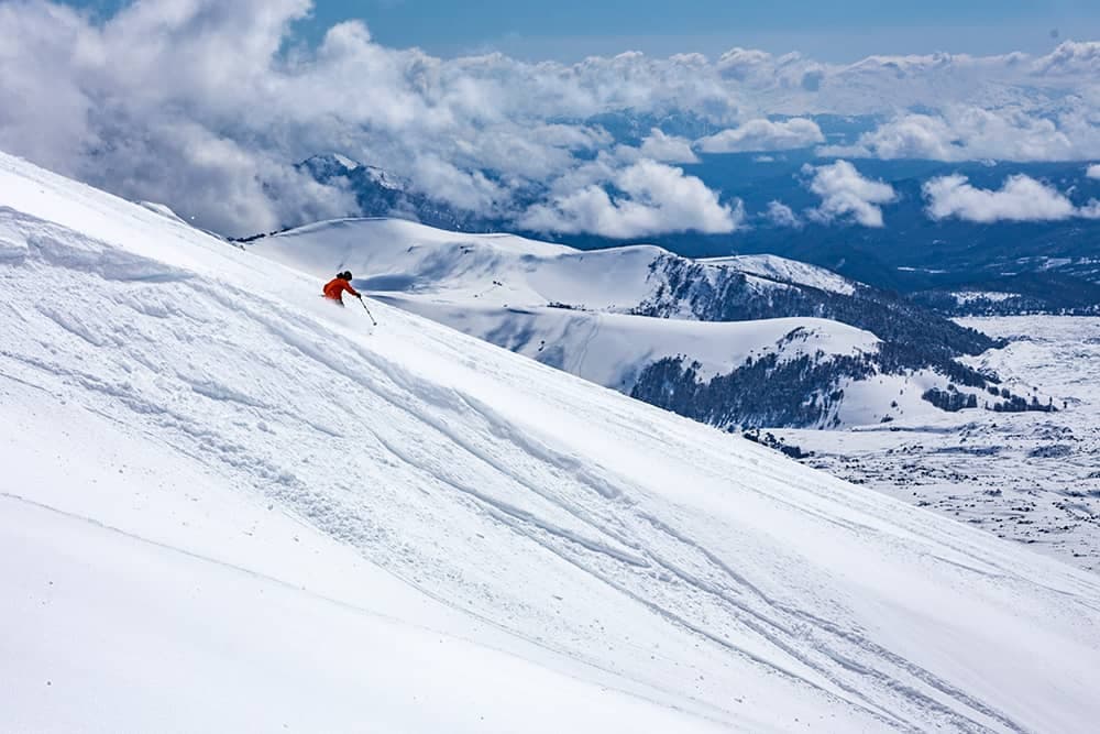
Corralco
Outstanding
↗improving
Scroll for happiness
Last Snowfall
Jul 16
todayPast 24 Hours
14.7cm
Reported by CorralcoPast 48 Hours
68.7cm
Past 10 Days
96.2cm
14-Day Forecast
94.1cm
Snow Depth
4cm
Powder Days
12
2026 season
Bluebird Days
1
2026 season
Overview
Corralco is a ski resort in South America, Chile. Today's SnowSure™ Score is 62/100 (Outstanding), snow base 4 cm (1.6 in), 90 cm (35.4 in) of snow in the last 7 days. The 14-day ensemble forecast across seven weather models (ECMWF, GFS, GEM, JMA, ICON, Météo-France, Met Norway) calls for ~94 cm (37 in) of new snow. Conditions last updated 2026-07-16 20:02 UTC.
Resort Guide
Corralco is a ski resort located on the slopes of the Lonquimay Volcano in the Araucanía region of southern Chile. The resort features over 1,800 hectares of skiable terrain, modern lifts, and a variety of runs suitable for all levels, set within the scenic Malalcahuello National Reserve. Corralco is known for its pristine natural surroundings, reliable snow conditions, and tranquil atmosphere, offering guests amenities such as a mountain hotel, spa, and guided excursions. Its unique setting among ancient araucaria forests and volcanic landscapes distinguishes it as a premier destination for both skiing and nature experiences.
Gallery
Click to expand • 2 total photos
Terrain & lifts
Resort-reported stats for Corralco
Lifts
8
Skiable area
171 ac
Longest run
5 km
Runs by difficulty(29 total)
Beginner
7
25% of terrain
Intermediate
13
45% of terrain
Advanced
9
30% of terrain
Run counts estimated from resort-reported totals and terrain mix.
Lift fleet
- High-speed quad1
- Double chair2
- Surface lift4
Resort Info
Season dates
Future dates are operator estimates and may change.
Ski passes
Indy Pass
Access tiers change by season — confirm benefits on the pass operator's site.
Top Après Ski
Bar Nevados – This cozy après-ski bar at Corralco is celebrated for its warm ambiance, signature cocktails, and panoramic views of the Lonquimay volcano, making it a favorite spot for skiers to unwind after a day on the slopes.
Major snowfall ahead - 211cm forecast.
Corralco is currently experiencing moderate snowfall, with 90cm recorded over the past week. The temperature is a chilly -3°C, and wind speeds are at 17 km/h, creating a brisk atmosphere on the slopes.
AI-generated summaryDepth
4cm depth — adequate for most conditions.
Recent
In the last 48 hours, 69cm of new snow has fallen.
Forecast
The 14-day outlook predicts an average of 105cm more snow.
Historic
Season-to-date snowfall is at 230cm, which is 87% of the 5-year average for this time of year.
Data updated Thu, Jul 16, 08:02 PM UTC
Snow Summary
Updated Jul 16, 2026 at 8:02 PM
Historical data from Open-Meteo archive • Forecast from ECMWF IFS model
Snowfall Forecast Maps
Andes (Chile & Argentina) region
Current Conditions
Reported Thu, Jul 16, 08:02 PM UTC
Depth by source
every reading we have- Resort ReportedBase 4cm · Mid 4cm
- Open-MeteoBase 56cm · Summit 56cm
The headline depth uses the most trusted available source. We show every reading so you can judge for yourself.
Freezing Level
1867m
🌡️ Mid-mountain - mixed conditions
Base
1440m
Temp
2.8°C
Wind
16.5km/h
Snow Depth
4cm
Resort reported
Resort 4cm · Model 56cm
14-Day Forecast
146.7cm
Mid-Mountain
1920m
Temp
--°C
Wind
18km/h
Snow Depth
4cm
Resort reported
14-Day Forecast
94.1cm
Summit
2400m
Temp
-3.5°C
Wind
16.5km/h
Snow Depth
4cm
Resort reported
14-Day Forecast
137cm
Ops signals
- ●Fresh snow + cold temps — good grooming window next 48h
Lifts Open
open
Runs Open
Live Conditions
Corralco Webcams
Corralco
Corralco
Corralco
Corralco
Local Reports
0 reportsDaily Snowfall Forecast by Model
Black line = verified SnowSure™ blend (not a simple average). Weights update weekly from measured snowfall at SNOTEL stations and resort reports.
SnowSure™ blend — verified model weighting
The black line is not a simple average. For Corralco (andes), we combine seven global weather models using weights learned from daily forecast verification — comparing each model's prediction to measured snowfall (SNOTEL, resort reports, ERA5).
- 1.Horizon buckets: days 1–3, 4–7, and 8–14 each get separate weights — short-range skill differs from long-range.
- 2.Regional calibration: weights come from verified error in this geography (Rockies, Alps, Japan, etc.), recalculated weekly.
- 3.Ground truth only: we never grade a forecast against another model — only against measured snow.
Building verification history for this resort.
How we verify forecasts →Hourly Forecast Detail
AM / PM / Night breakdown with wind and freezing level
NWP models refresh up to 4× daily · Last synced Jul 16, 8:02 PM
Today -2 / -630.6cm43.8mm | Fri, Jul 17 -1 / -78cm11.4mm | Sat, Jul 18 -5 / -811.9cm17.1mm | Sun, Jul 19 -2 / -90.4cm0.6mm | Mon, Jul 20 -4 / -12 | Tue, Jul 21 -4 / -123.8cm5.1mm | |||||||||||||
|---|---|---|---|---|---|---|---|---|---|---|---|---|---|---|---|---|---|---|
| Period | AM | PM | Night | AM | PM | Night | AM | PM | Night | AM | PM | Night | AM | PM | Night | AM | PM | Night |
| Snow (cm) | 6.5 | 8.6 | 15.5 | 0 | 0.2 | 7.8 | 5.2 | 0.8 | 5.9 | 0 | 0 | 0.4 | 0 | 0 | 0 | 2.5 | 1.3 | 0 |
| Precip (mm) | 9.3 | 12.3 | 22.2 | 0 | 0.3 | 11.1 | 7.5 | 1.2 | 8.4 | 0 | 0 | 0.6 | 0 | 0 | 0 | 3.3 | 1.8 | 0 |
| Temp (°C) | -3 | -3 | -6 | -5 | -3 | -6 | -7 | -6 | -6 | -6 | -3 | -7 | -8 | -4 | -10 | -8 | -5 | -10 |
| Wind (km/h) | 12 | 21 | 7 | 3 | 5 | 5 | 8 | 7 | 5 | 4 | 3 | 2 | 1 | 3 | 4 | 11 | 4 | 7 |
| Gusts (km/h) | 62 | 89 | 43 | 22 | 23 | 25 | 47 | 30 | 29 | 16 | 14 | 17 | 27 | 39 | 26 | 38 | 57 | 33 |
14-Day Snow Forecast by Model
Summit elevation (2400m)
10-Day Forecast
Today
16
❄️
-1.8°
-6.1°
33.3cm
25 km/h
Fri
17
❄️
-1.5°
-6.7°
5.3cm
8 km/h
Sat
18
❄️
-5.3°
-7.8°
16cm
11 km/h
Sun
19
❄️
-1.8°
-9°
1.7cm
5 km/h
Mon
20
☁️
-3.7°
-12.2°
0.1cm
8 km/h
Tue
21
❄️
-4.4°
-12.4°
3.6cm
12 km/h
Wed
22
❄️
-5.4°
-11.1°
20.3cm
13 km/h
Thu
23
❄️
-4.1°
-7.9°
4.6cm
8 km/h
Fri
24
❄️
-5.1°
-6.8°
26.9cm
10 km/h
Sat
25
❄️
-2.7°
-10.1°
1.8cm
9 km/h
Summit elevation (2400m) • ECMWF model
Season vs Historic
Updated Thu, Jul 16, 08:02 PM UTC
230.8cm
Season Total
This Season to Date
-12%
vs 5-Year Avg
263cm avg by now
-12%
vs 30-Year Avg
263cm avg by now
263cm
5-Yr Avg by Now
Over the past five years, average seasonal snowfall has increased significantly compared to the 30-year average, with the 5-year mean (245.9 cm) exceeding the long-term average (158.5 cm) by 55%. The 2023 season stands out as an anomaly, recording 496.9 cm—more than triple the 30-year average—while 2020 saw an unusually low total of just 51.4 cm. The most recent season (2024) recorded 173.9 cm, which is 51% below the 5-year average but still 10% above the 30-year average, indicating substantial year-to-year variability. Overall, recent years have been marked by both higher averages and pronounced fluctuations in snowfall.
Corralco Snow History
Average annual snowfall is 601cm with an average of 78 snowfall days per season. The table below shows monthly averages across 31 seasons of archive data (modeled snowpack at mid-elevation).
| Month | Avg Snowfall | Snowfall Days | Avg Base Depth | Max Base Depth | Biggest Snowfall |
|---|---|---|---|---|---|
| June | 160.2cm | 17 days | 43cm | 88cm | 31cm |
| July | 142.1cm | 17 days | 94cm | 126cm | 28.4cm |
| August | 152.5cm | 17 days | 129cm | 169cm | 31.7cm |
| September | 85.9cm | 13 days | 130cm | 160cm | 21.9cm |
| October | 49.6cm | 10 days | 83cm | 119cm | 16.3cm |
Source: SnowSure archive · Open-Meteo ERA5 reanalysis at mid-elevation. Depth is modeled, not resort-reported.
Season at a Glance
Next season(2026)
Opens Jun 13, 2026
Multi-season averages will appear once SnowSure has tracked more than one full season.
Best Months to Visit
August
Peak Season
July
Peak Season
September
Good
June
Good
Note: Based on typical ski season patterns for this region.


