
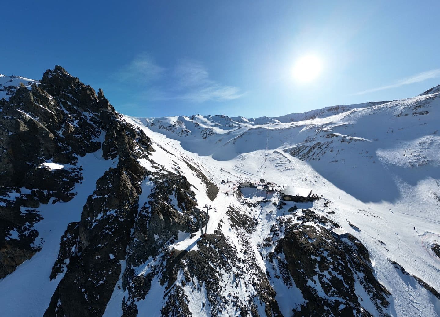
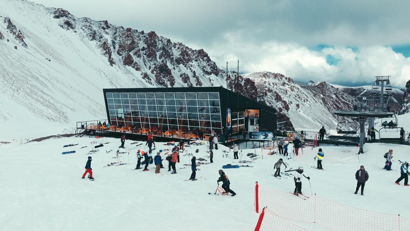
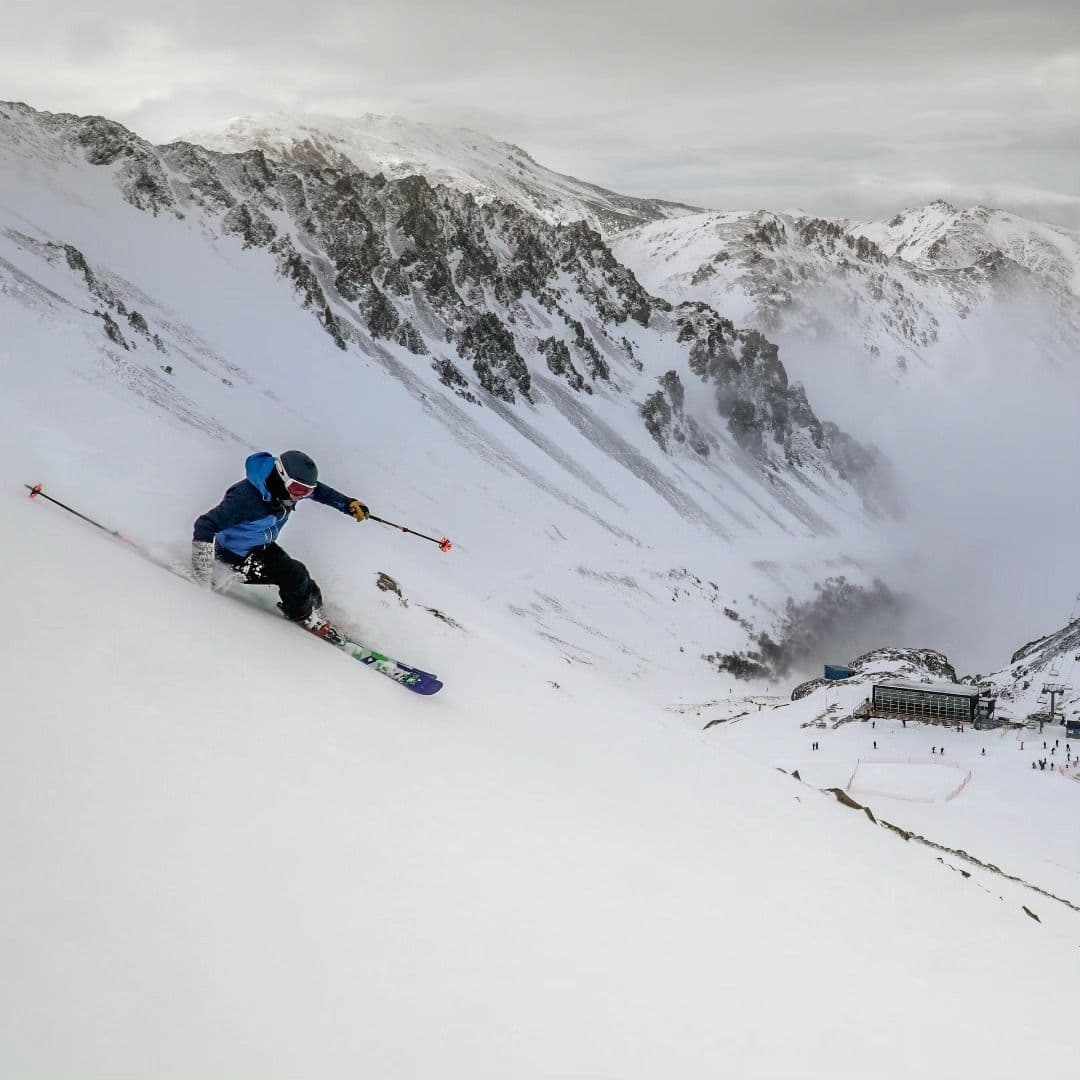
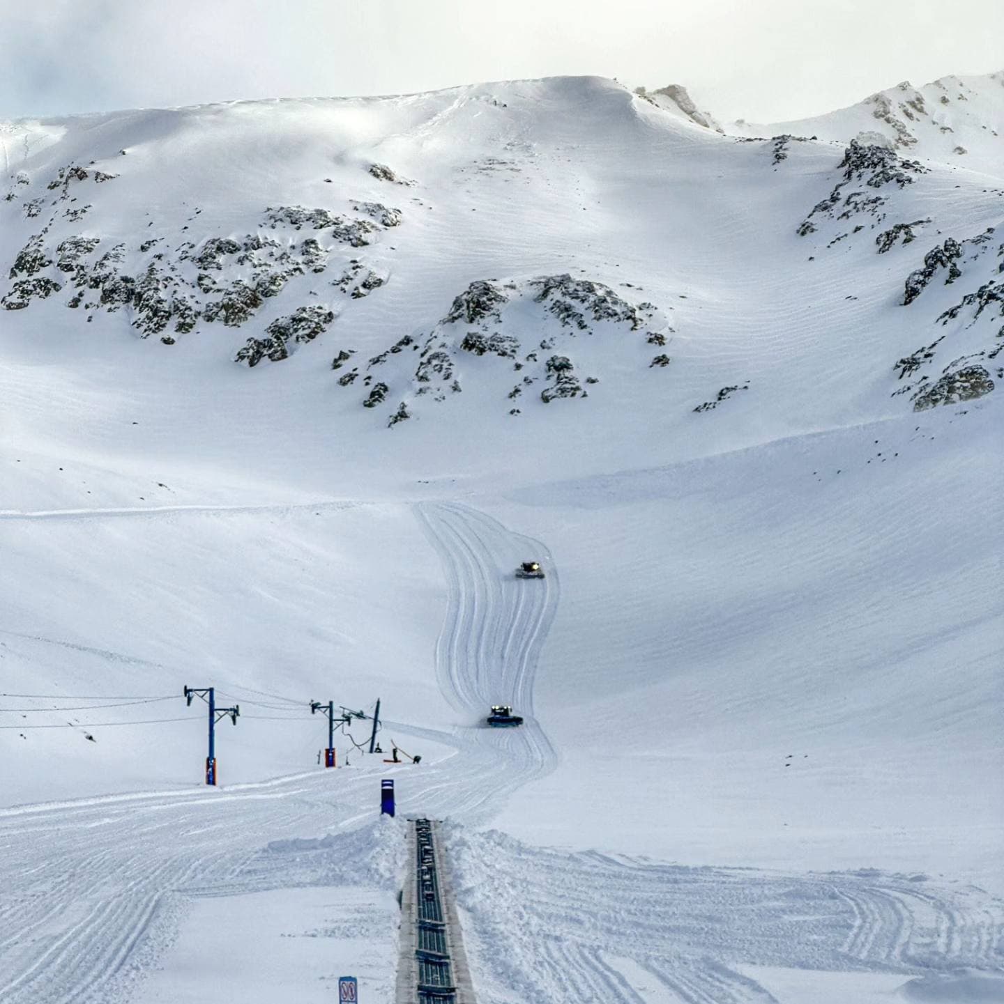
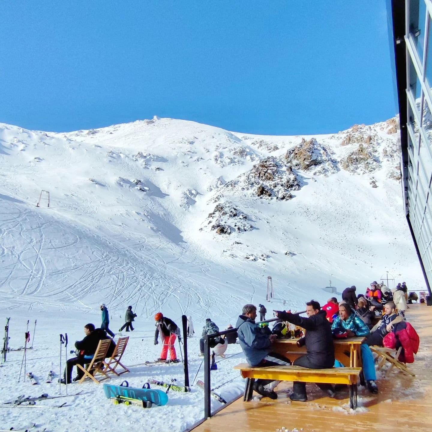
📷 La Hoya
South America
La Hoya
Fair
→stable
Scroll for happiness
Last Snowfall
Jul 16
todayPast 24 Hours
2.7cm
Reported by La HoyaPast 48 Hours
2.8cm
Past 10 Days
28.4cm
14-Day Forecast
12.8cm
Snow Depth
5cm
Powder Days
7
2026 season
Bluebird Days
2
2026 season
Overview
La Hoya is a ski resort in South America, Argentina. Today's SnowSure™ Score is 25/100 (Fair), snow base 5 cm (2 in), 1 cm (0.4 in) of new snow in the last 24 hours. The 14-day ensemble forecast across seven weather models (ECMWF, GFS, GEM, JMA, ICON, Météo-France, Met Norway) calls for ~13 cm (5.1 in) of new snow. Conditions last updated 2026-07-16 21:02 UTC.
Resort Guide
La Hoya is a ski resort located near Esquel in the province of Chubut, Argentina, known for its reliable snow conditions and extended winter season. The resort offers a variety of ski and snowboard runs suitable for all levels, a ski school, equipment rental, and pedestrian activities, all set in a relaxed Patagonian mountain environment. Signature experiences include panoramic views, well-maintained slopes, and a family-friendly atmosphere, with amenities such as on-mountain dining and modern safety infrastructure. La Hoya stands out for its quality snow, accessibility, and scenic setting in the Argentine Andes.
Gallery

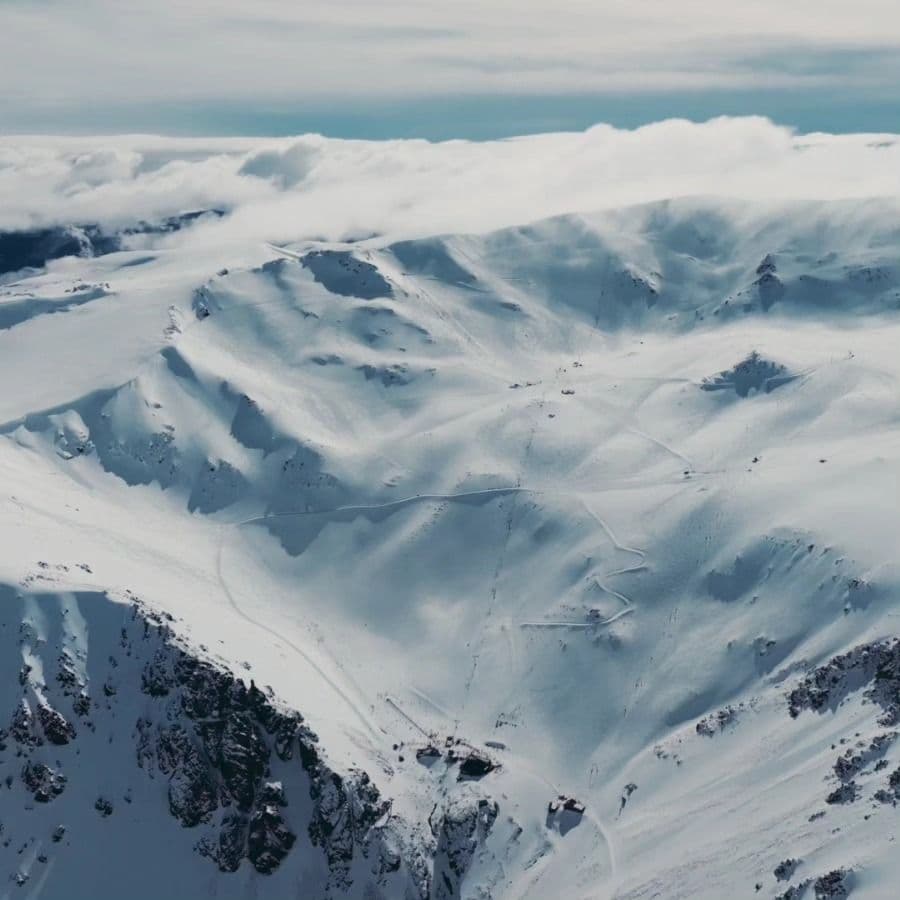
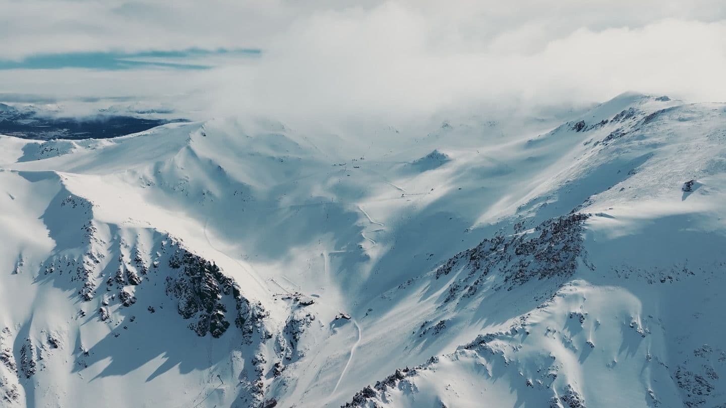
Click to expand • 9 total photos
Terrain & lifts
Resort-reported stats for La Hoya
Lifts
8
Skiable area
85.5 ac
Longest run
5.1 km / 3.2 mi
Runs by difficulty(24 total)
Beginner
2
10% of terrain
Intermediate
7
30% of terrain
Advanced
10
40% of terrain
Expert
5
20% of terrain
Run counts estimated from resort-reported totals and terrain mix.
Terrain by difficulty
- Beginner10%
- Intermediate30%
- Advanced40%
- Expert20%
Lift fleet
- Quad chair1
- Double chair3
- Surface lift4
Resort Info
Season dates
Future dates are operator estimates and may change.
Ski passes
No ski pass found
Access tiers change by season — confirm benefits on the pass operator's site.
Top Après Ski
La Cima Bar – Renowned for its panoramic mountain views and cozy alpine ambiance, La Cima Bar is the go-to après-ski spot at La Hoya, offering a welcoming atmosphere, hearty snacks, and a selection of local wines and craft beers perfect for unwinding after a day on the slopes.
Adequate snow - check forecasts before booking.
Current conditions at La Hoya show a snow depth of 5cm with overcast skies and a temperature of -2°C. In the past week, 4cm of snow has fallen, contributing to a season total of 61cm, which is 67% of the 5-year average for this time of year. Looking ahead, the 14-day forecast suggests an average of 13cm of additional snowfall.
AI-generated summaryDepth
5cm depth — adequate for most conditions.
Recent
There has been 1cm of snowfall in the last week.
Forecast
The 14-day snow outlook averages between 17cm to 26cm, indicating a potential for improved conditions.
Historic
This season's snow total of 61cm is 67% of the 5-year average for this time of year.
Data updated Thu, Jul 16, 09:02 PM UTC
Snow Summary
Updated Jul 16, 2026 at 9:02 PM
Historical data from Open-Meteo archive • Forecast from ECMWF IFS model
Snowfall Forecast Maps
Andes (Chile & Argentina) region
Current Conditions
Reported Thu, Jul 16, 09:02 PM UTC
Depth by source
every reading we have- Resort ReportedBase 5cm
- GHCNBase 6cm
- Open-MeteoBase 34cm · Summit 34cm
The headline depth uses the most trusted available source. We show every reading so you can judge for yourself.
Freezing Level
1814m
🌡️ Mid-mountain - mixed conditions
Base
1430m
Temp
2.5°C
Wind
7.9km/h
Snow Depth
5cm
Resort reported
Resort 5cm · Model 34cm
14-Day Forecast
19.7cm
Mid-Mountain
1753m
Temp
--°C
Wind
9km/h
Snow Depth
5cm
Resort reported
14-Day Forecast
12.8cm
Summit
2075m
Temp
-1.7°C
Wind
7.9km/h
Snow Depth
5cm
Resort reported
14-Day Forecast
23cm
Lifts Open
open
Runs Open
open
Live Conditions
La Hoya Webcams
La Hoya / Varitech
La Hoya / Varitech
Local Reports
0 reportsDaily Snowfall Forecast by Model
Black line = verified SnowSure™ blend (not a simple average). Weights update weekly from measured snowfall at SNOTEL stations and resort reports.
SnowSure™ blend — verified model weighting
The black line is not a simple average. For La Hoya (andes), we combine seven global weather models using weights learned from daily forecast verification — comparing each model's prediction to measured snowfall (SNOTEL, resort reports, ERA5).
- 1.Horizon buckets: days 1–3, 4–7, and 8–14 each get separate weights — short-range skill differs from long-range.
- 2.Regional calibration: weights come from verified error in this geography (Rockies, Alps, Japan, etc.), recalculated weekly.
- 3.Ground truth only: we never grade a forecast against another model — only against measured snow.
Building verification history for this resort.
How we verify forecasts →Hourly Forecast Detail
AM / PM / Night breakdown with wind and freezing level
NWP models refresh up to 4× daily · Last synced Jul 16, 9:02 PM
Today -1 / -66.4cm9.2mm | Fri, Jul 17 -3 / -90.9cm1.2mm | Sat, Jul 18 -5 / -12 | Sun, Jul 19 -8 / -15 | Mon, Jul 20 -5 / -13 | Tue, Jul 21 -7 / -101.3cm1.8mm | |||||||||||||
|---|---|---|---|---|---|---|---|---|---|---|---|---|---|---|---|---|---|---|
| Period | AM | PM | Night | AM | PM | Night | AM | PM | Night | AM | PM | Night | AM | PM | Night | AM | PM | Night |
| Snow (cm) | 3.4 | 1.5 | 1.5 | 0.4 | 0 | 0.5 | 0 | 0 | 0 | 0 | 0 | 0 | 0 | 0 | 0 | 0 | 0.6 | 0.7 |
| Precip (mm) | 4.9 | 2.1 | 2.2 | 0.5 | 0 | 0.7 | 0 | 0 | 0 | 0 | 0 | 0 | 0 | 0 | 0 | 0 | 0.8 | 1 |
| Temp (°C) | -4 | -2 | -4 | -5 | -5 | -5 | -9 | -6 | -9 | -13 | -8 | -12 | -12 | -6 | -10 | -9 | -7 | -9 |
| Wind (km/h) | 4 | 8 | 8 | 16 | 14 | 9 | 1 | 5 | 3 | 2 | 6 | 2 | 2 | 4 | 3 | 9 | 14 | 7 |
| Gusts (km/h) | 31 | 45 | 43 | 64 | 50 | 45 | 12 | 20 | 17 | 12 | 21 | 14 | 14 | 21 | 20 | 30 | 43 | 35 |
14-Day Snow Forecast by Model
Summit elevation (2075m)
10-Day Forecast
Today
16
❄️
-1.3°
-6.1°
6.6cm
16 km/h
Fri
17
❄️
-2.7°
-8.7°
1cm
18 km/h
Sat
18
☁️
-4.9°
-11.9°
7 km/h
Sun
19
☁️
-7.8°
-14.6°
8 km/h
Mon
20
☁️
-5.3°
-13.2°
5 km/h
Tue
21
❄️
-6.6°
-10.3°
1.1cm
16 km/h
Wed
22
❄️
-4.7°
-11.7°
1.8cm
7 km/h
Thu
23
❄️
-5.3°
-8.2°
9.1cm
8 km/h
Fri
24
❄️
-3.9°
-7°
6.9cm
12 km/h
Sat
25
❄️
-4.6°
-9.6°
2.1cm
9 km/h
Summit elevation (2075m) • ECMWF model
Season vs Historic
Updated Thu, Jul 16, 09:02 PM UTC
61cm
Season Total
This Season to Date
-33%
vs 5-Year Avg
91cm avg by now
-33%
vs 30-Year Avg
91cm avg by now
91cm
5-Yr Avg by Now
Snowfall over the past five years has averaged 108.3 cm, significantly exceeding the 30-year average of 71.5 cm, indicating a marked upward trend in recent seasons. The 2021 season stands out as an anomaly with 167.7 cm, well above both short- and long-term averages, while 2020 saw a notable low at 61 cm. The most recent season's snowfall is 50% higher than the 5-year average and 76% above the 30-year average, underscoring a period of heightened snowfall variability and overall increase compared to historical norms.
La Hoya Snow History
Average annual snowfall is 209cm with an average of 71 snowfall days per season. The table below shows monthly averages across 31 seasons of archive data (modeled snowpack at mid-elevation).
| Month | Avg Snowfall | Snowfall Days | Avg Base Depth | Max Base Depth | Biggest Snowfall |
|---|---|---|---|---|---|
| June | 53.4cm | 16 days | 17cm | 34cm | 13.3cm |
| July | 53.7cm | 16 days | 37cm | 51cm | 15.2cm |
| August | 50.8cm | 17 days | 43cm | 57cm | 13.3cm |
| September | 26.7cm | 12 days | 31cm | 46cm | 9.6cm |
| October | 19.5cm | 9 days | 9cm | 22cm | 8.9cm |
Source: SnowSure archive · Open-Meteo ERA5 reanalysis at mid-elevation. Depth is modeled, not resort-reported.
Season at a Glance
Next season(2026)
Opens Jun 26, 2026
Multi-season averages will appear once SnowSure has tracked more than one full season.
Best Months to Visit
August
Peak Season
July
Peak Season
September
Good
June
Good
Note: Based on typical ski season patterns for this region.


