
Early-October Andes System
5 resorts in the path, 66cm at the biggest. Likely — the models agree on this one.
+66CM
Predicted at Valle Nevado
34–103cm across the models
Storm
Oct 6–8
5 resorts in the path
Peak
Oct 6
46cm at Valle Nevado
Predicted
66cm
Valle Nevado · 34–103cm across the models
Confidence
Likely
Updated
Oct 6, 00:30 UTC
SnowSure Forecaster
Written from the blend and the model spread · updated Oct 6, 00:30 UTC
The window opened today, with final predictions of 66cm for Valle Nevado, 65.9cm for La Parva, 63.1cm for Portillo, 54.1cm for Lagunillas, and 39.3cm for Penitentes. Since our initial forecast, the top total has decreased by 32.1cm, and the window start has shifted one day later. Despite these adjustments, confidence remains likely, and we expect the most significant snowfall on October 6, with totals reaching 46.1cm for Valle Nevado, 46.2cm for La Parva, and 46.6cm for Portillo.
Forecast log
Every entry, newest first. Nothing is overwritten.
- Day 13·Oct 6·Likely·66cmLanded
The window opened today: 54–66cm for Valle Nevado, La Parva
The window opened today, with final predictions of 66cm for Valle Nevado, 65.9cm for La Parva, 63.1cm for Portillo, 54.1cm for Lagunillas, and 39.3cm for Penitentes. Since our initial forecast, the top total has decreased by 32.1cm, and the window start has shifted one day later. Despite these adjustments, confidence remains likely, and we expect the most significant snowfall on October 6, with totals reaching 46.1cm for Valle Nevado, 46.2cm for La Parva, and 46.6cm for Portillo.
Window Oct 6–8 · Valle Nevado
- Day 12·Oct 3·Likely·66cm(-32)
Confidence holds: 54–66cm for Valle Nevado, La Parva Oct 6–8
Day 12: the window has slid a day later, but totals remain strong. We expect 66cm for Valle Nevado and 65.9cm for La Parva during the window from October 6 to 8. Portillo is forecasted to receive 63.1cm, while Lagunillas and Penitentes are looking at 54.1cm and 39.3cm, respectively. The biggest day for all resorts is projected for October 6, with Valle Nevado leading at 46.1cm. Confidence in these totals is still likely, and we are on track with the trends. As we approach the event, we will continue to monitor any shifts in timing or totals.
Window Oct 6–8 · Valle Nevado
- Day 11·Oct 2·Likely·98cmFirst prediction
Confidence builds: 51–159.6cm for La Parva Oct 5–8
The prediction for the early-October Andes system indicates La Parva receiving 98.1cm, with a range of 51–159.6cm. This storm is expected to deliver significant snowfall across the region, driven by a favorable pattern for moisture and temperature. La Parva and Valle Nevado are positioned to receive the most snow, both projected to see their biggest day on October 6 with 53.7cm. Portillo and Lagunillas are also likely to benefit, though with slightly lower totals. Penitentes may see less impact, but still receives a respectable 63.2cm. Changes in the forecast could arise from shifts in moisture availability or temperature fluctuations.
Window Oct 5–8 · La Parva
Snow by day
Oct 5 – Oct 9, with a day either side. For each resort: where the freeze line sits against the mountain, then what falls — snow in cm, rain in mm — and the day read from those two numbers.
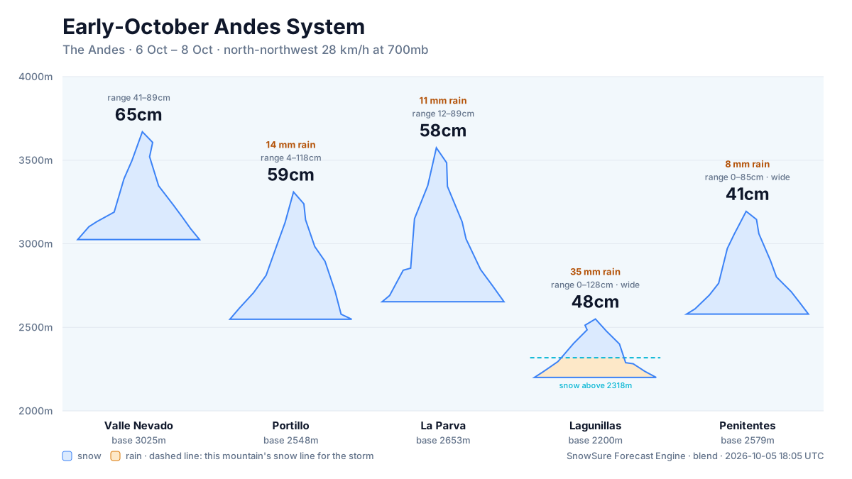
Valle Nevadobase 2,860 m · summit 3,670 m
—cm snow
no daily data
La Parvabase 2,653 m · summit 3,574 m
—cm snow
no daily data
Portillobase 2,548 m · summit 3,310 m
—cm snow
no daily data
Lagunillasbase 2,200 m · summit 2,550 m
—cm snow
no daily data
Penitentesbase 2,579 m · summit 3,194 m
—cm snow
no daily data
No daily series on file for these resorts yet.
Rain / snow line
Base to summit for each mountain, with the snow line cut across them.
The system
700mb flow — where the storm is, and what is steering it. Pins sized by forecast total.
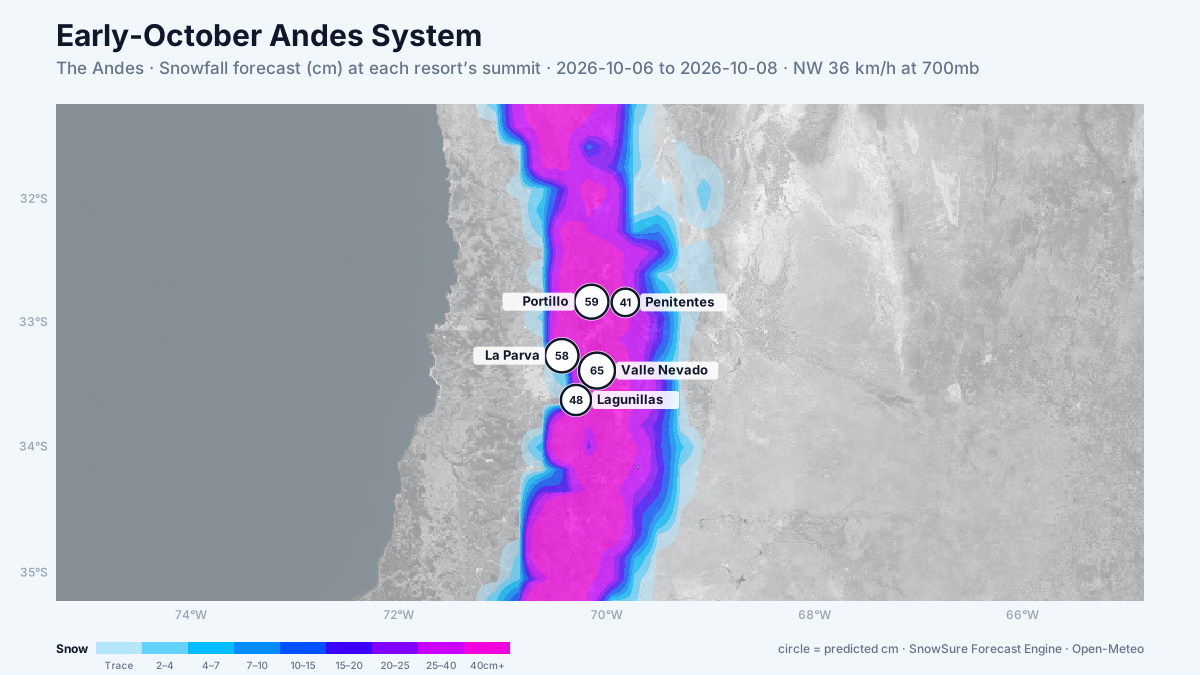
72-hour snowfall forecast for the same window.

In the path
The prediction is what we said before the snow. The receipt is what actually fell.
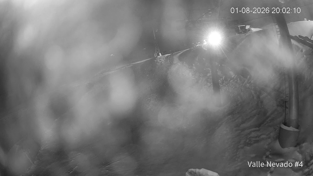 LiveValle Nevadobiggest day 46cm on 6 Oct · on trackPredicted66cm
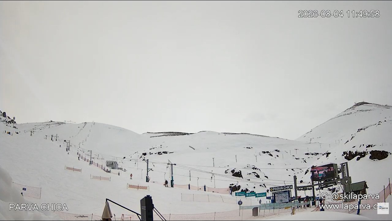 LiveLa Parvabiggest day 46cm on 6 Oct · on trackPredicted66cm
LivePortillobiggest day 47cm on 6 Oct · on trackPredicted63cm
- Lagunillasbiggest day 35cm on 6 Oct · on trackPredicted54cm
- Penitentesbiggest day 29cm on 6 Oct · on trackPredicted39cm
What fell
Every watch ends in a public receipt, hit or miss.
- Valle NevadoWe predicted 66cm. 122cm fell.Hit
- La ParvaWe predicted 66cm. 75cm fell.Hit
- PortilloWe predicted 63cm. 23cm fell.Miss
Last updated 2026-10-06 00:30 UTC. SnowSure scans a blend of seven weather models twice daily and flags systems clearing 30cm over 72 hours, three to fourteen days out. This watch opened on 2026-09-30 with 39cm forecast at Valle Nevado.


