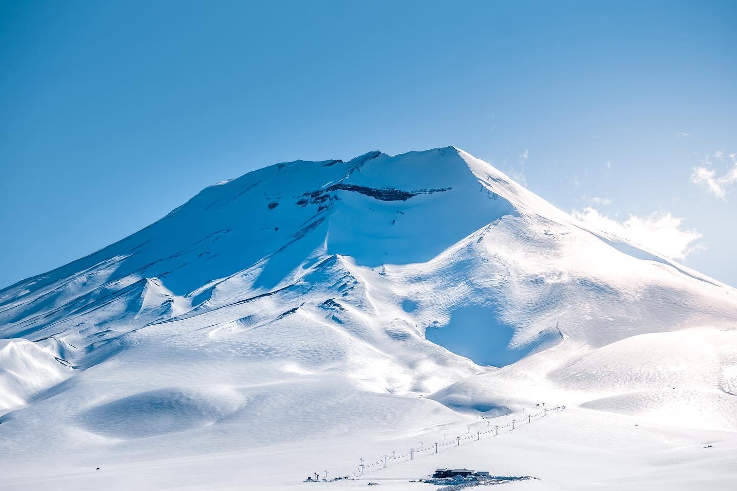
Mid-September Andes System
12 resorts in the path, 114cm at the biggest. Watching — the models see it but do not yet agree closely; likely at 1 of 12 resorts.
+114CM
Predicted at Nevados de Chillán
62–163cm across the models
Storm
Sep 18–26
12 resorts in the path
Peak
Sep 24
57cm at Corralco
Predicted
114cm
Nevados de Chillán · 62–163cm across the models
Confidence
Watching
Likely at 1 of 12 resorts
Updated
Sep 20, 00:30 UTC
SnowSure Forecaster
Written from the blend and the model spread · updated Sep 20, 00:30 UTC
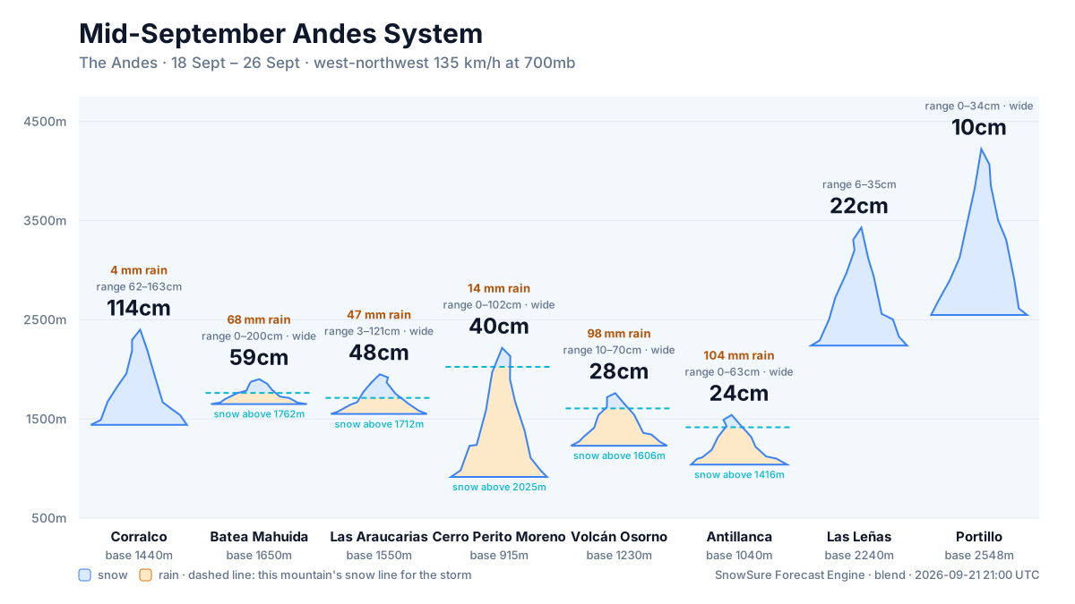
Current prediction: 62–163cm for Corralco between 2026-09-18 and 2026-09-24, 114cm our central figure. The biggest day is 2026-09-24 at 57cm. Also in the path: Batea Mahuida 59cm, Las Araucarias 48cm, Cerro Perito Moreno 40cm, and 8 more. Confidence is watching: the signal has crossed our threshold but the models still disagree on how much. By resort: Likely at 1 of 12 resorts. On day one we said 47cm for Corralco; that is the number we are measured against. These figures are re-read from the latest model blend; each entry in the log keeps what we said at the time.
Forecast log
Every entry, newest first. Nothing is overwritten.
- Day 9·Sep 20·Likely·134cmLanded
The window opened today: 133.6cm for Nevados de Chillán 2026-09-22 to 2026-09-27
The window opened today with final predictions of 133.6cm for Nevados de Chillán, 126.7cm for Corralco, and lower totals for Cerro Catedral, Cerro Perito Moreno, and Batea Mahuida. Since day 1, the top total has decreased by 14cm, and the window start has shifted one day later. Confidence remains likely, with trends on track for the two leading resorts. We continue to monitor the situation closely, especially for the resorts with lower totals where confidence is categorized as watching.
Window Sep 22–27 · Nevados de Chillán
- Day 8·Sep 19·Likely·134cm(-14)
Confidence holds: 133.6cm for Nevados de Chillán 2026-09-22 to 2026-09-27
Day 8: the window has slid a day later, and totals have adjusted accordingly. We now expect 133.6cm for Nevados de Chillán and 126.7cm for Corralco over the window from 2026-09-22 to 2026-09-27. Both resorts show likely confidence, with the biggest day expected on 2026-09-24 at 62.3cm for Nevados de Chillán and 43.2cm for Corralco. Cerro Catedral and Cerro Perito Moreno are still under observation, with totals of 53.8cm and 53.6cm respectively, while Batea Mahuida is projected to receive 34.1cm. We will continue to monitor the trends as the window approaches.
Window Sep 22–27 · Nevados de Chillán
- Day 7·Sep 18·Likely·148cm(-50)
Confidence holds: 147.6cm for Corralco 2026-09-21 to 2026-09-27
Day 7: the window start moved one day later, and totals are down 49.8cm at the top. The current prediction for the window from 2026-09-21 to 2026-09-27 shows Corralco leading with 147.6cm, followed by Nevados de Chillán at 112.8cm. Other resorts like Las Araucarias and Cerro Catedral are also expected to see significant totals, but with lower maximums. We will continue to monitor trends closely, especially at Batea Mahuida, where confidence is still being assessed.
Window Sep 21–27 · Corralco
- Day 6·Sep 17·Likely·197cm(-1)
Confidence holds: 197.4cm for Nevados de Chillán 2026-09-20 to 2026-09-27
Day 6: the window has shifted one day later, but totals remain stable with a slight decrease at the top. The current prediction for the window from 2026-09-20 to 2026-09-27 shows Nevados de Chillán leading with 197.4cm, followed by Corralco at 178.2cm. Other resorts like Volcán Osorno and Portillo are also expected to see significant snowfall, with totals of 102.7cm and 76.1cm respectively. We will continue to monitor the trends closely, especially for resorts like Cerro Perito Moreno and Las Leñas, where confidence is watching and trends are weakening.
Window Sep 20–27 · Nevados de Chillán
- Day 5·Sep 16·Likely·198cm(+16)
Confidence builds: 198.2cm for Nevados de Chillán 2026-09-19 to 2026-09-26
Day 5: the window has slid a day later, and totals are up 16.4cm at Nevados de Chillán since our last update. We expect snowfall from September 19 to September 26, with Nevados de Chillán leading the forecast at 198.2cm, followed by Corralco at 168.2cm. Other resorts show promising totals, with Batea Mahuida at 98.5cm and Volcán Osorno at 85.9cm. While confidence is likely at 12 of 15 resorts, we are watching the trends closely, particularly at Batea Mahuida and Cerro Catedral, which are strengthening but still uncertain.
Window Sep 19–26 · Nevados de Chillán
- Day 4·Sep 15·Watching·182cm(+92)
Confidence builds: 181.8cm for Nevados de Chillán 2026-09-18 to 2026-09-26
Day 4: totals up 92.1cm since the previous entry and the window held. Our current prediction for the event window from 2026-09-18 to 2026-09-26 shows Nevados de Chillán leading with 181.8cm, followed by Corralco at 152.9cm and Volcán Osorno at 108.3cm. Confidence remains watching across the board, with trends varying among resorts. Notably, Volcán Osorno and Batea Mahuida show strengthening trends, while Las Araucarias and others are experiencing weakening or delayed trends. We will continue to monitor these developments closely as we approach the event window.
Window Sep 18–26 · Nevados de Chillán
- Day 3·Sep 14·Watching·90cmFirst prediction
Confidence builds: 89.7cm for Portillo 2026-09-18 to 2026-09-25
The prediction for the upcoming mid-September Andes system indicates a total of 89.7cm for Portillo, with a range of 22–178.6cm. This pattern suggests a favorable setup for snow accumulation across the region. Portillo is likely to see the most significant totals, while Cerro Catedral, Nevados de Chillán, and Corralco are also positioned to benefit, albeit with lower expected amounts of 52.1cm, 47cm, and 47cm respectively. Resorts like Cerro Perito Moreno and Penitentes may see totals around 46.4cm and 39.8cm, while La Parva and Las Araucarias are expected to receive 33.8cm and 32.8cm. A shift in the storm's trajectory or intensity could alter these predictions significantly.
Window Sep 18–25 · Portillo
Snow by day
Sep 17 – Sep 27, with a day either side. For each resort: where the freeze line sits against the mountain, then what falls — snow in cm, rain in mm — and the day read from those two numbers.
Corralcobase 1,440 m · summit 2,400 m
114cm snow20mm rain
Modelled at the summit, 2,400 m · snow above 2,280 m
linem
/ raincm · mm
Thu
Sep 17
—
Fri
Sep 18
—
Sat
Sep 19
—
Sun
Sep 20
—
Mon
Sep 21
Snow
Tue
Sep 22
Mixed
Wed
Sep 23
Snow
Thu
Sep 24
Snow
Fri
Sep 25
Mixed
Sat
Sep 26
Mixed
Sun
Sep 27
Mixed
snow Mon, Wed, Thu · rain low, snow high Tue, Fri, Sat (above about 2,280 m)
Batea Mahuidabase 1,650 m · summit 1,900 m
59cm snow68mm rain
Modelled at the summit, 1,900 m · rain on the whole mountain
linem
/ raincm · mm
Thu
Sep 17
—
Fri
Sep 18
—
Sat
Sep 19
—
Sun
Sep 20
—
Mon
Sep 21
Snow
Tue
Sep 22
Rain
Wed
Sep 23
Mixed
Thu
Sep 24
Mixed
Fri
Sep 25
Mixed
Sat
Sep 26
Mixed
Sun
Sep 27
Mixed
snow Mon · rain low, snow high Wed, Thu, Fri, Sat · rain Tue
Las Araucariasbase 1,550 m · summit 1,950 m
48cm snow176mm rain
Modelled at the summit, 1,950 m · rain on the whole mountain
linem
/ raincm · mm
Thu
Sep 17
—
Fri
Sep 18
—
Sat
Sep 19
—
Sun
Sep 20
—
Mon
Sep 21
Snow
Tue
Sep 22
Mixed
Wed
Sep 23
Mixed
Thu
Sep 24
Mixed
Fri
Sep 25
Rain
Sat
Sep 26
Rain
Sun
Sep 27
Mixed
snow Mon · rain low, snow high Tue, Wed, Thu · rain Fri, Sat
Cerro Perito Morenobase 915 m · summit 2,216 m
40cm snow16mm rain
Modelled at the summit, 2,216 m · snow above 2,140 m
linem
/ raincm · mm
Thu
Sep 17
—
Fri
Sep 18
—
Sat
Sep 19
—
Sun
Sep 20
—
Mon
Sep 21
Snow
Tue
Sep 22
Snow
Wed
Sep 23
Mixed
Thu
Sep 24
Mixed
Fri
Sep 25
Mixed
Sat
Sep 26
Mixed
Sun
Sep 27
Snow
snow Mon, Tue · rain low, snow high Wed, Thu, Fri, Sat (above about 2,140 m)
Volcán Osornobase 1,230 m · summit 1,760 m
28cm snow212mm rain
Modelled at the summit, 1,760 m · rain on the whole mountain
linem
/ raincm · mm
Thu
Sep 17
—
Fri
Sep 18
—
Sat
Sep 19
—
Sun
Sep 20
—
Mon
Sep 21
Snow
Tue
Sep 22
Snow
Wed
Sep 23
Rain
Thu
Sep 24
Rain
Fri
Sep 25
Rain
Sat
Sep 26
Mixed
Sun
Sep 27
Rain
snow Mon, Tue · rain low, snow high Sat · rain Wed, Thu, Fri
Antillancabase 1,040 m · summit 1,540 m
24cm snow229mm rain
Modelled at the summit, 1,540 m · snow above 1,100 m
linem
/ raincm · mm
Thu
Sep 17
—
Fri
Sep 18
—
Sat
Sep 19
—
Sun
Sep 20
—
Mon
Sep 21
Mixed
Tue
Sep 22
Mixed
Wed
Sep 23
Rain
Thu
Sep 24
Rain
Fri
Sep 25
Rain
Sat
Sep 26
Rain
Sun
Sep 27
Rain
rain low, snow high Mon, Tue (above about 1,100 m) · rain Wed, Thu, Fri, Sat
Las Leñasbase 2,240 m · summit 3,430 m
22cm snow
Modelled at the summit, 3,430 m · snow to the base
linem
/ raincm · mm
Thu
Sep 17
—
Fri
Sep 18
—
Sat
Sep 19
—
Sun
Sep 20
—
Mon
Sep 21
Snow
Tue
Sep 22
Dry
Wed
Sep 23
Snow
Thu
Sep 24
Snow
Fri
Sep 25
Snow
Sat
Sep 26
Snow
Sun
Sep 27
Snow
snow Mon, Wed, Thu, Fri, Sat
Portillobase 2,548 m · summit 4,222 m
10cm snow
Modelled at the summit, 4,222 m · snow to the base
linem
/ raincm · mm
Thu
Sep 17
—
Fri
Sep 18
—
Sat
Sep 19
—
Sun
Sep 20
—
Mon
Sep 21
Snow
Tue
Sep 22
Dry
Wed
Sep 23
Snow
Thu
Sep 24
Snow
Fri
Sep 25
Snow
Sat
Sep 26
Snow
Sun
Sep 27
Dry
snow Mon, Wed, Thu, Fri, Sat
Antucobase 1,400 m · summit 1,850 m
6cm snow148mm rain
Modelled at the summit, 1,850 m · rain on the whole mountain
linem
/ raincm · mm
Thu
Sep 17
—
Fri
Sep 18
—
Sat
Sep 19
—
Sun
Sep 20
—
Mon
Sep 21
Snow
Tue
Sep 22
—
Wed
Sep 23
Rain
Thu
Sep 24
Mixed
Fri
Sep 25
Rain
Sat
Sep 26
Rain
Sun
Sep 27
Rain
snow Mon · rain low, snow high Thu · rain Wed, Fri, Sat
Nevados de Chillánbase 1,600 m · summit 2,499 m
4cm snow25mm rain
Modelled at the summit, 2,499 m · snow to the base
linem
/ raincm · mm
Thu
Sep 17
—
Fri
Sep 18
—
Sat
Sep 19
—
Sun
Sep 20
—
Mon
Sep 21
Snow
Tue
Sep 22
Dry
Wed
Sep 23
Mixed
Thu
Sep 24
Snow
Fri
Sep 25
Mixed
Sat
Sep 26
Mixed
Sun
Sep 27
Snow
snow Mon, Thu · rain low, snow high Wed, Fri, Sat
La Parvabase 2,653 m · summit 3,574 m
2cm snow4mm rain
Modelled at the summit, 3,574 m · snow to the base
linem
/ raincm · mm
Thu
Sep 17
—
Fri
Sep 18
—
Sat
Sep 19
—
Sun
Sep 20
—
Mon
Sep 21
Snow
Tue
Sep 22
—
Wed
Sep 23
Snow
Thu
Sep 24
Snow
Fri
Sep 25
Snow
Sat
Sep 26
Snow
Sun
Sep 27
Dry
snow every day
Valle Nevadobase 3,025 m · summit 3,670 m
2cm snow3mm rain
Modelled at the summit, 3,670 m · snow to the base
linem
/ raincm · mm
Thu
Sep 17
—
Fri
Sep 18
—
Sat
Sep 19
—
Sun
Sep 20
—
Mon
Sep 21
Snow
Tue
Sep 22
—
Wed
Sep 23
Snow
Thu
Sep 24
Snow
Fri
Sep 25
Snow
Sat
Sep 26
Snow
Sun
Sep 27
Dry
snow every day
snowrain low, snow highraindryThe dots are the freeze line — the height where rain turns to snow. Solid: straight from the models. Hollow: estimated from temperature. Above the summit line it rains on the whole mountain; below the base line it snows all the way down. Blue bars are snow in cm, amber bars rain in mm; the totals above are their sums.
Rain / snow line
Base to summit for each mountain, with the snow line cut across them.
The system
700mb flow — where the storm is, and what is steering it. Pins sized by forecast total.
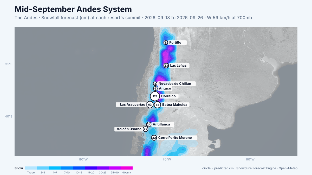
72-hour snowfall forecast for the same window.

In the path
Forecast, not observation — none of this has fallen yet. Totals are across the window. We will post what fell when the window closes.
LiveCorralcobiggest day 57cm on 24 Sep · newPredicted114cm62–163cm across the models
- Batea Mahuidabiggest day 27cm on 23 Sep · strengtheningPredicted59cm0–200cm, models far apart
- Las Araucariasbiggest day 41cm on 23 Sep · newPredicted48cm3–121cm, models far apart
- Cerro Perito Morenobiggest day 19cm on 24 Sep · newPredicted40cm0–102cm, models far apart
- Volcán Osornobiggest day 16cm on 22 Sep · delayedPredicted28cm10–70cm, models far apart
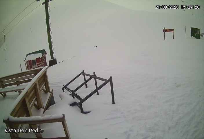 LiveAntillancabiggest day 15cm on 22 Sep · newPredicted24cm0–63cm, models far apart
 LiveLas Leñasbiggest day 18cm on 24 Sep · newPredicted22cm6–35cm across the models
LivePortillobiggest day 6cm on 24 Sep · newPredicted10cm0–34cm, models far apart
- Antucobiggest day 6cm on 21 Sep · newPredicted6cm0–17cm, models far apart
LiveNevados de Chillánbiggest day 4cm on 21 Sep · newPredicted4cm2–9cm across the models
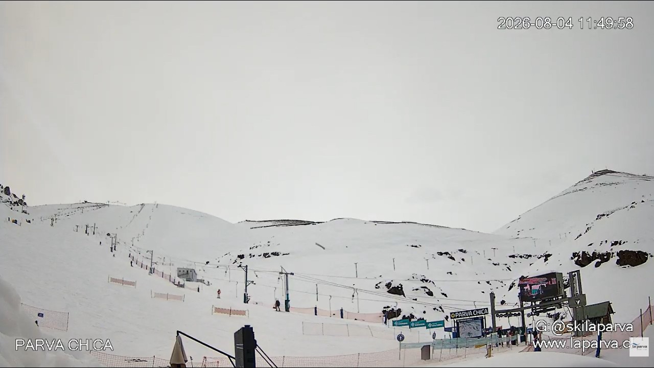 LiveLa Parvabiggest day 2cm on 21 Sep · newPredicted2cm0–10cm, models far apart
 LiveValle Nevadobiggest day 2cm on 21 Sep · newPredicted2cm0–10cm, models far apart
Last updated 2026-09-16 00:30 UTC. SnowSure scans a blend of seven weather models twice daily and flags systems clearing 30cm over 72 hours, three to fourteen days out. This watch opened on 2026-09-11 with 46cm forecast at Corralco.


